
Icefields Parkway: Banff to Jasper Stop by Stop
Driving the Icefields Parkway: all 232 km from Lake Louise to Jasper, the stops worth making, fuel and cell coverage gaps, and the winter tire rule.
The Icefields Parkway runs 232 km from the Lake Louise junction to Jasper, and Parks Canada describes it in plain terms: a remote roadway with limited services and no cell coverage. Three hours if you drive it straight through, a full day if you stop properly, and it deserves the full day. The practical rules are short - fill the tank before you start, don’t count on a phone signal, and from 1 November to 31 March, or whenever else snow or ice covers the road, your vehicle must have snow tires or chains.
Parks Canada’s Banff driving page says snow tires or chains are required by law on this road; it publishes no fine and doesn’t say four-wheel drive. A front-wheel-drive car on proper winter tires is legal and, in practice, fine; an all-wheel-drive rental on summer tires is neither. Rental desks in Calgary don’t always volunteer this, so ask what’s fitted before you sign.
What the drive costs
A park pass is required for the whole route: C$12.25 per adult per day, C$24.50 for a family or group of up to seven in one vehicle, and free for anyone 17 or under. From 19 June to 7 September 2026 admission was free for everyone under the Canada Strong Pass; from 8 September 2026 the rates above apply again. Fuel for the one-way drive in a normal car runs to about the same again, so C$50 covers a one-way day trip for two before you buy so much as a coffee.
The paid extras all sit at the Columbia Icefield. Ticket types, 2026 hours and whether the Ice Explorer is worth the stop are in Columbia Icefield Skywalk and glacier tickets - easy to skip if the budget is tight.
Which direction and how long
Most people drive north, Banff to Jasper, which puts the big glacier views ahead of you rather than in the mirror. Southbound has its own advantage: afternoon light on the peaks above Bow Lake. Either way, plan eight to ten hours door to door with the stops below, or split it over two days with a night in Jasper.
Starting early matters for more than parking. In winter, snow clearing runs from 7 am to 3:30 pm, so a crossing that starts at noon can end on an unploughed road in the dark.
Stop 1: Lake Louise junction, km 0
The parkway begins where Highway 93 North leaves the Trans-Canada. This is the last easy fuel, food and mobile signal until Jasper, and the last place to check the forecast.
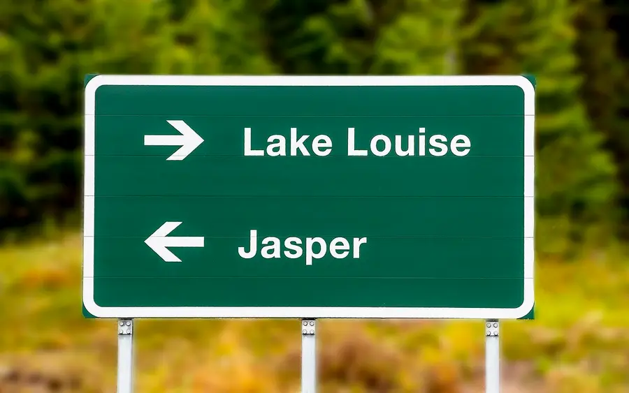
If you’ve come up from the townsite, our Banff guide covers the lakes and the shuttle system you’ll have already dealt with that morning.
Stop 2: Bow Lake, km 36
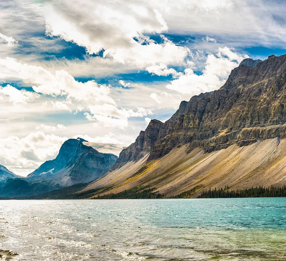
Bow Lake sits right against the road with a flat shoreline path, the Bow Glacier hanging at the far end and Crowfoot Mountain over your shoulder. Twenty minutes gets you a good look; ninety gets you most of the way to Bow Glacier Falls.
Stop 3: Peyto Lake and Bow Summit, km 40
Four kilometres later the road tops out at Bow Summit, the highest point on the parkway. The walk from the parking lot to the viewing platform takes about ten minutes uphill on pavement, and the lake below is the improbable turquoise that rock flour gives glacial water in summer.
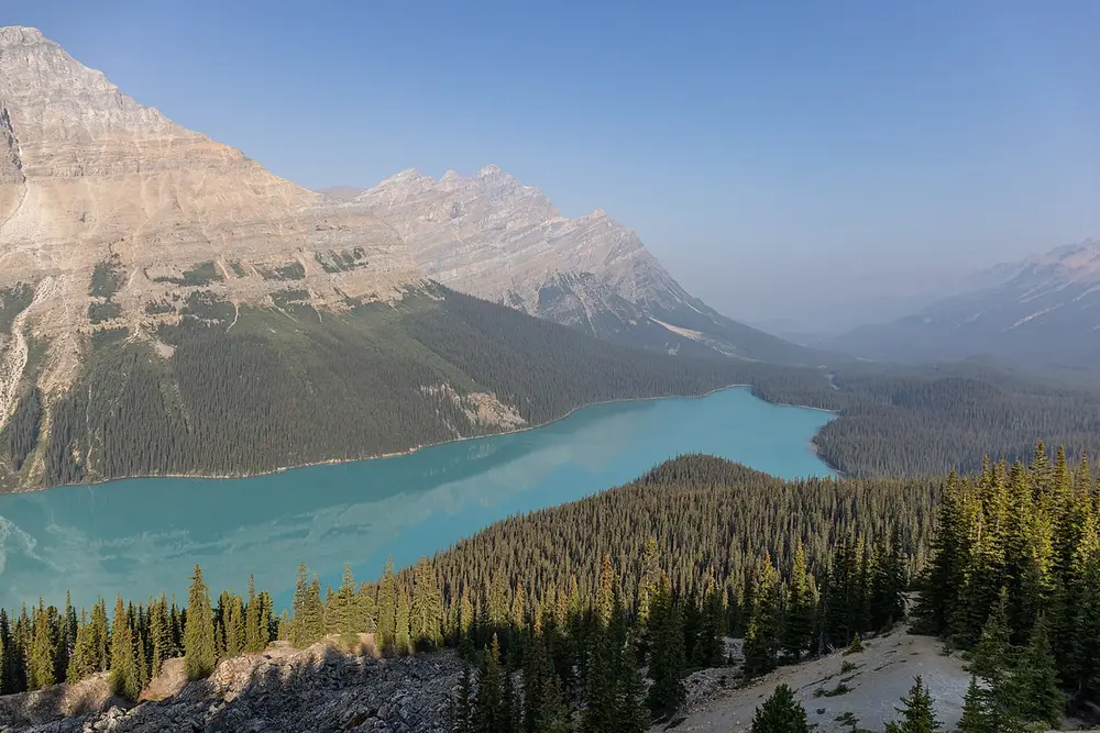
Come before 9 am or after 5 pm if you want the platform to yourself. The parking lot is the bottleneck, not the trail.
Stop 4: Mistaya Canyon, km 72
The easiest stop to drive past. A small pull-out on the west side leads to a ten-minute walk downhill, and at the bottom the Mistaya River has drilled a slot through limestone so smooth it looks machined.
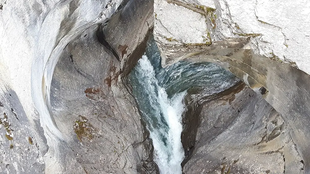
The walk back up is the only work of the day. It’s also the point where the crowds thin out, because the tour buses stay on the Peyto and Icefield schedule.
Stop 5: Saskatchewan River Crossing, km 77
Where the North Saskatchewan, Mistaya and Howse rivers meet, the valley opens into a braided gravel plain and the only services on the route appear: a service station, a store, a pub and rooms at The Crossing.
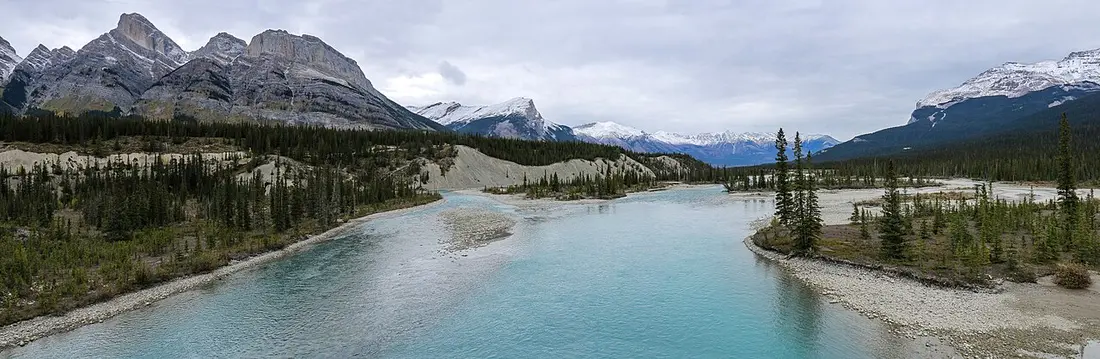
The Crossing is seasonal and its hours aren’t the sort of thing to bet a fuel gauge on. Parks Canada’s winter guidance is blunter still: in winter there are no services at all between Jasper and Lake Louise. Fill up at the start of the day and this stop becomes a bonus rather than a rescue.
Stop 6: the Big Bend and Parker Ridge, km 115
North of the Crossing the road climbs a wall of mountain in one long hairpin, the Big Bend, with the Weeping Wall seeping down the cliffs below it. At the top of the climb, near Sunwapta Pass and the boundary between Banff and Jasper, the Parker Ridge trail switchbacks up an open slope to a view of the Saskatchewan Glacier that most parkway drivers never see.
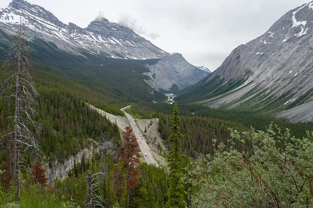
Bighorn sheep hang around this stretch and are used to cars, which is exactly why people get too close. Stay 30 m back and stay in the vehicle when they’re on the road.
Stop 7: Columbia Icefield, km 127
The Icefield Centre sits across the road from the toe of the Athabasca Glacier, and even from the parking lot the scale is obvious. Parks Canada notes the glacier has been receding for the last 125 years, and the walk from the lower parking lot up the moraine passes markers showing where the ice used to end.
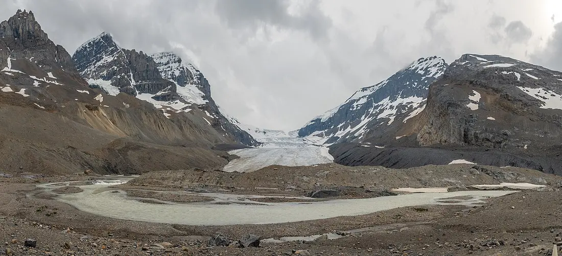
Take the warning at the barriers seriously. Parks Canada’s wording is unusually direct: the glacier is dangerous, don’t cross the barriers, and people have been killed falling into hidden crevasses. Walking onto the ice is done with a guide or not at all - for the commercial Ice Explorer and glass Skywalk, see Columbia Icefield Skywalk and glacier tickets.
Stops 8 and 9: Sunwapta and Athabasca falls, km 176 and 200
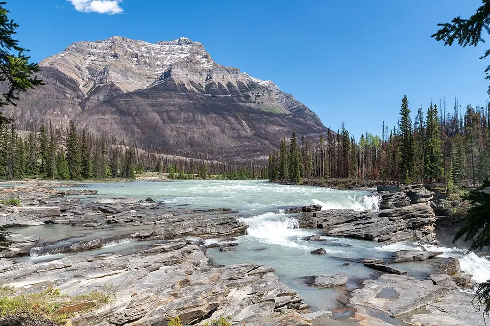
Both are short walks from the road, both are worth stopping for, and they’re different animals. Sunwapta Falls drops into a narrow gorge beside an island of spruce; the lower falls, a further 1.3 km down the trail, get a fraction of the visitors.
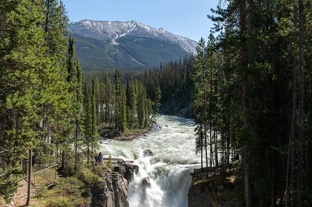
Athabasca Falls carries far more water through a much tighter gorge, with paved paths, railings and a potholed slot you can look straight down into. It’s the busiest stop on the northern half; early evening is calmer and the light is better.
Stop 10: into Jasper, km 232
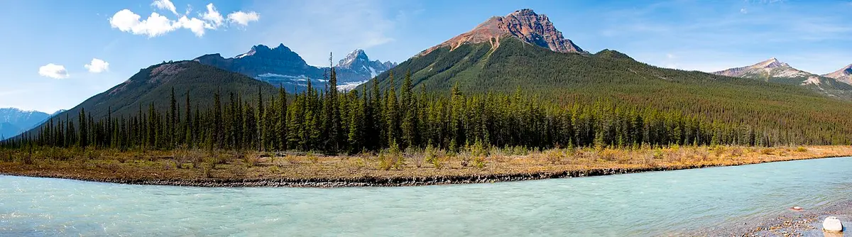
The last stretch runs down the Sunwapta and Athabasca valleys, wide and braided, with the mountains stepping back from the road.
Book a room before you arrive. The town is still rebuilding after the 2024 wildfire and beds are tighter than the old guidebooks suggest - our Jasper guide has the current list of what’s open and what’s not.
The safety brief nobody prints
- No cell service. Parks Canada is explicit: coverage exists at each end of the parkway, not on it. Download offline maps before you leave, and tell someone when you expect to arrive. A local SIM changes nothing where there’s no tower.
- Fuel discipline. Leave with a full tank, treat Saskatchewan River Crossing as optional, and remember that idling in a queue at the Icefield burns fuel too.
- Winter kit. Parks Canada’s list for a winter crossing is water, energy bars, candles and matches, blankets or sleeping bags, and proper winter clothing for everyone in the car. Road conditions come from 511 Alberta on 1-855-391-9743.
- Wildlife on the road. Sheep, elk and bears all use the verge. Slow down, stay in the car, and never stop in a driving lane.
- Weather changes with altitude. Bow Summit and Sunwapta Pass hold snow when Banff is in shorts, and the gap can be two seasons wide in June.
Read also
- The park at the southern end: Banff National Park
- The park at the northern end: Jasper National Park
- Every park we cover: national parks hub
- Getting the right car for it: car rental in Canada
- Driving it in a motorhome: RV rental in Canada
Route day by day
- Days on the road
- 1
- Distance
- ≈232 km
- Budget from
- 50 CAD
- Best season
- May, June, July, August, September, October
The route at a glance
-
Lake Louise junction (start of Highway 93N)
Route startstop ≈30 min
Last reliable fuel, food and mobile signal before Jasper. Fill the tank here even if it is half full.
Photo: Ron Cogswell · CC BY 2.0 · Wikimedia Commons ( source) -
Bow Lake and Crowfoot Glacier
36 km from the startstop ≈40 min
Roadside lake with a walkable shoreline and the Bow Glacier at the far end. The Crowfoot Glacier viewpoint is a few kilometres before it.
Photo: David Zhang · CC BY-SA 2.0 · Wikimedia Commons ( source) -
Peyto Lake and Bow Summit
40 km from the startstop ≈45 min
The highest point on the parkway. Ten minutes uphill from the parking lot to the viewing platform over the lake.
Photo: Balon Greyjoy · CC BY-SA 3.0 · Wikimedia Commons ( source) -
Mistaya Canyon
72 km from the startstop ≈30 min
Ten-minute walk downhill from an easily missed pull-out to a slot canyon drilled through polished limestone.
Photo: simpf · CC BY-SA 2.0 · Wikimedia Commons ( source) -
Saskatchewan River Crossing
77 km from the startstop ≈30 min
The only fuel, food and rooms between Lake Louise and Jasper, and it is seasonal. Treat it as a bonus, not a plan.
Photo: Martin Kraft · CC BY-SA 3.0 · Wikimedia Commons ( source) -
The Big Bend and Parker Ridge
115 km from the startstop ≈60 min
The road swings through a hairpin and climbs to the Sunwapta Pass. Parker Ridge is the best short hike on the drive; bighorn sheep are common here.
Photo: Ethan Sahagun · CC BY-SA 4.0 · Wikimedia Commons ( source) -
Columbia Icefield and the Athabasca Glacier
127 km from the startstop ≈90 min
The Icefield Centre sits across the road from the glacier toe. Do not cross the safety barriers onto the ice.
Photo: Ethan Sahagun · CC BY 4.0 · Wikimedia Commons ( source) -
Sunwapta Falls
176 km from the startstop ≈30 min
Short walk from the parking lot to a bridge above the upper falls; the lower falls are a further 1.3 km down the trail and much quieter.
Photo: Hansueli Krapf · CC BY-SA 4.0 · Wikimedia Commons ( source) -
Athabasca Falls
200 km from the startstop ≈40 min
The heaviest water on the route, funnelled through a quartzite gorge. Paved paths and railings; busy at midday.
Photo: Hansueli Krapf · CC BY-SA 4.0 · Wikimedia Commons ( source) -
Jasper townsite
232 km from the startstop ≈0 min
End of Highway 93N. Fuel, food, mobile signal and rooms; book ahead, the town is still rebuilding after the 2024 fire.
Photo: Ron Cogswell · CC BY 2.0 · Wikimedia Commons ( source)
Route map
The map with stops loads on click - to keep the page lightweight.
The map didn’t load. Check your connection and refresh the page.