
Wells Gray Provincial Park: Waterfalls Off the Highway
Helmcken Falls is 145 m and the road stays open year-round. Spahats is 10 km off Hwy 5. No gate fee; camping and a C$20 non-resident add-on.
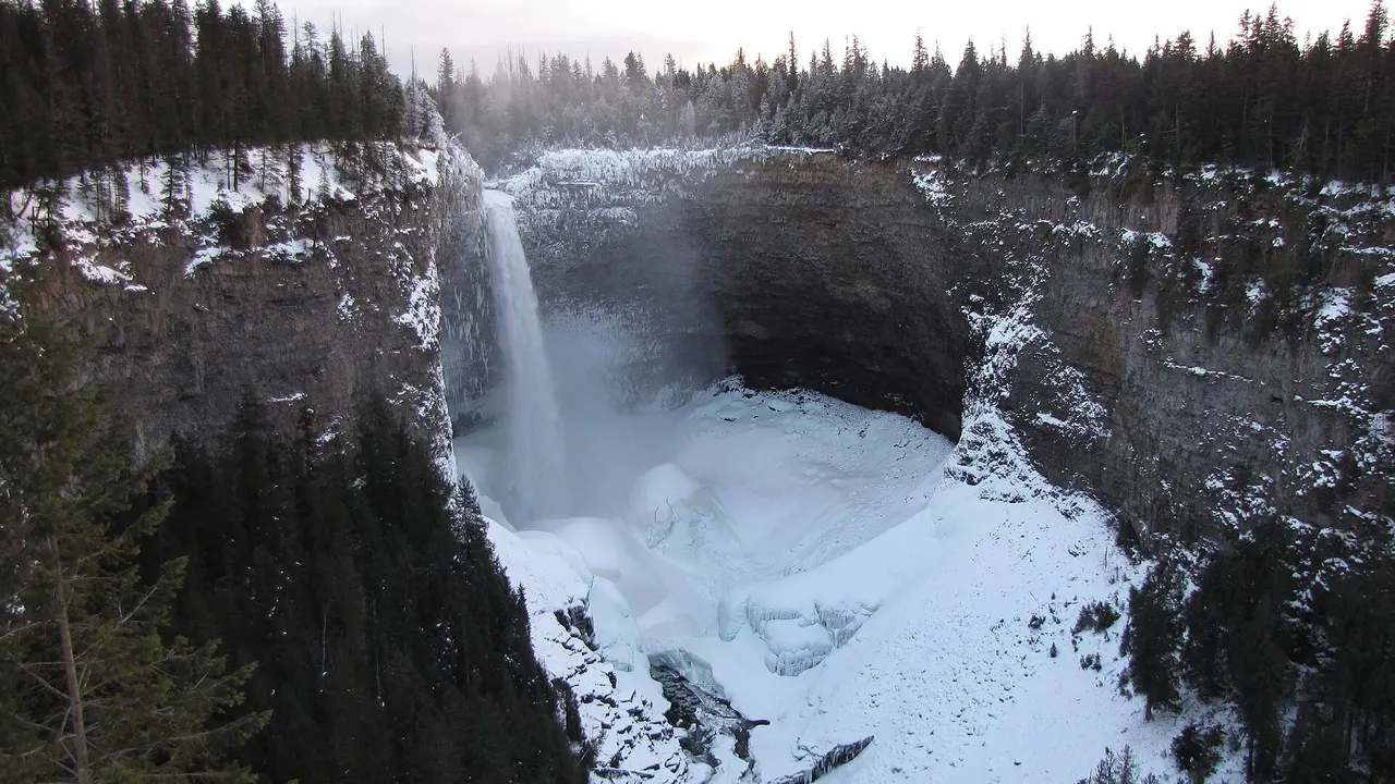
Wells Gray is the waterfall park you reach from Highway 5 at Clearwater, and the version most visitors actually do is a corridor drive, not a wilderness expedition. Helmcken Falls drops 145 metres into a lava canyon, BC Parks calls it the fourth-largest waterfall in Canada, and the road to that viewpoint stays open year-round. Spahats Falls is 10 km north of the highway. There is no Parks Canada gate here and no day-use pass of the Joffre Lakes kind on the park page - you pay when you camp.
That last point is why people from outside B.C. still get a surprise at the campground. Day-use isn’t priced on the Wells Gray page. Overnight is, and from 15 May 2026 anyone who can’t show a B.C. licence or services card pays an extra C$20 on top of the site fee. The waterfalls off the highway don’t care. The reservation receipt does.
Clearwater is the last town that counts
The core of the park - the Corridor, Spahats Creek, Trophy Mountain, Clearwater Lake - is reached off Highway 5 at Clearwater. Before you leave town, BC Parks wants you at the Wells Gray Information Centre at the junction of the highway and the park road. That’s where trail conditions, campsite availability and the day’s closures actually live. The park page points to a trail-conditions PDF (the copy linked in August 2026 was dated 15 July), and the corridor page is blunt about bears: this is grizzly and black-bear country, and feeding them gets people hurt and bears killed.
Clearwater is also the last reliable place to sort the car. The nearest public telephone BC Parks lists is at Helmcken Falls Lodge, 1 km south of the park entrance. If a British Columbia road trip treated Kamloops as a one-line dash, this is the detour north of that highway. The western Canada itinerary already sends a shortened week through Kamloops.
You need wheels. There isn’t a bus that drops you at Helmcken, and the gravel to Clearwater Lake is not a taxi job. Kamloops (YKA) is the realistic rental desk.
Four named falls, and which ones sit on the road
BC Parks names four waterfalls when it describes the park: Helmcken, Spahats, Moul and Dawson. It does not publish a total count. What it does publish is how you reach them.
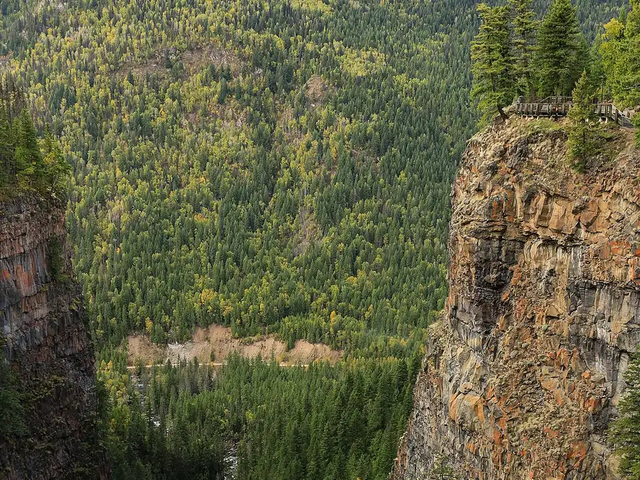
Spahats is the first. Ten kilometres north of Highway 5 on the Clearwater Valley Road, an easy walk from the parking lot to a viewing platform over the canyon Spahats Creek has cut through volcanic rock. A second platform, Shaden, looks down the Clearwater River corridor. There is no safety fence on the stretch between the falls platform and the picnic area to the north. Stay on the designated trail. That’s the whole stop, and it’s the one you can do on a tank of gas and an hour.
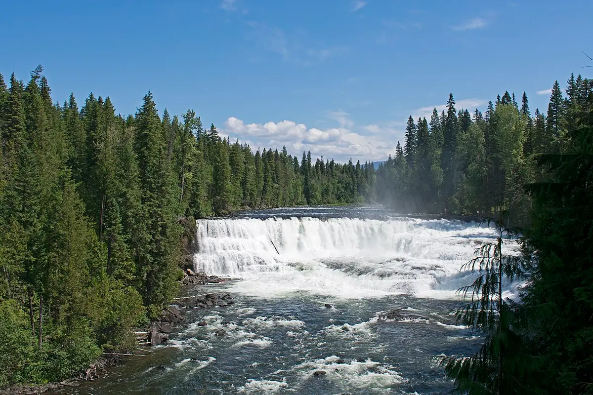
Dawson sits further up the corridor. BC Parks treats it as a winter sightseeing stop alongside Helmcken, which is a useful tell: you can reach it from the road in season. The Majerus Farm trail starts beside a warming hut just south of Dawson Falls if you want to walk once you’ve seen the water. Don’t confuse the roadside view with the 32 km farm-and-creek loop that leaves from the same neighbourhood.
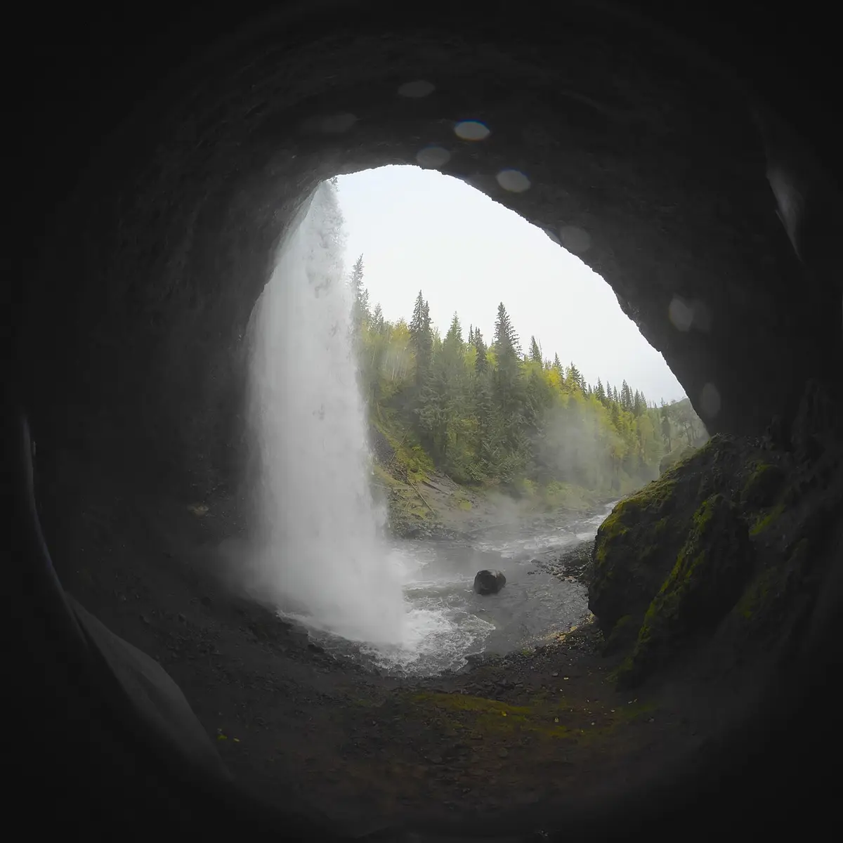
Moul is on the corridor hiking list. BC Parks does not put a kilometre figure next to it. Treat it as a walk, not a pull-off, and read the current trail report before you count on the cave behind the veil that photographs so well.
Helmcken is the one the road was built to show you. More on that below, because the viewpoint and the rim trail are not the same outing.
Two more water stops sit on the same corridor and aren’t in the famous four. Bailey’s Chute is a 2 km walk to a platform where chinook try to jump the rapids in late August and early September. Mahood Falls is a separate drive: the Mahood Lake access off Highway 24, a considerable distance from the Clearwater corridor. If you only drove north from town, you’re not there.
Helmcken: 145 metres, a viewpoint, and a rim with no fence
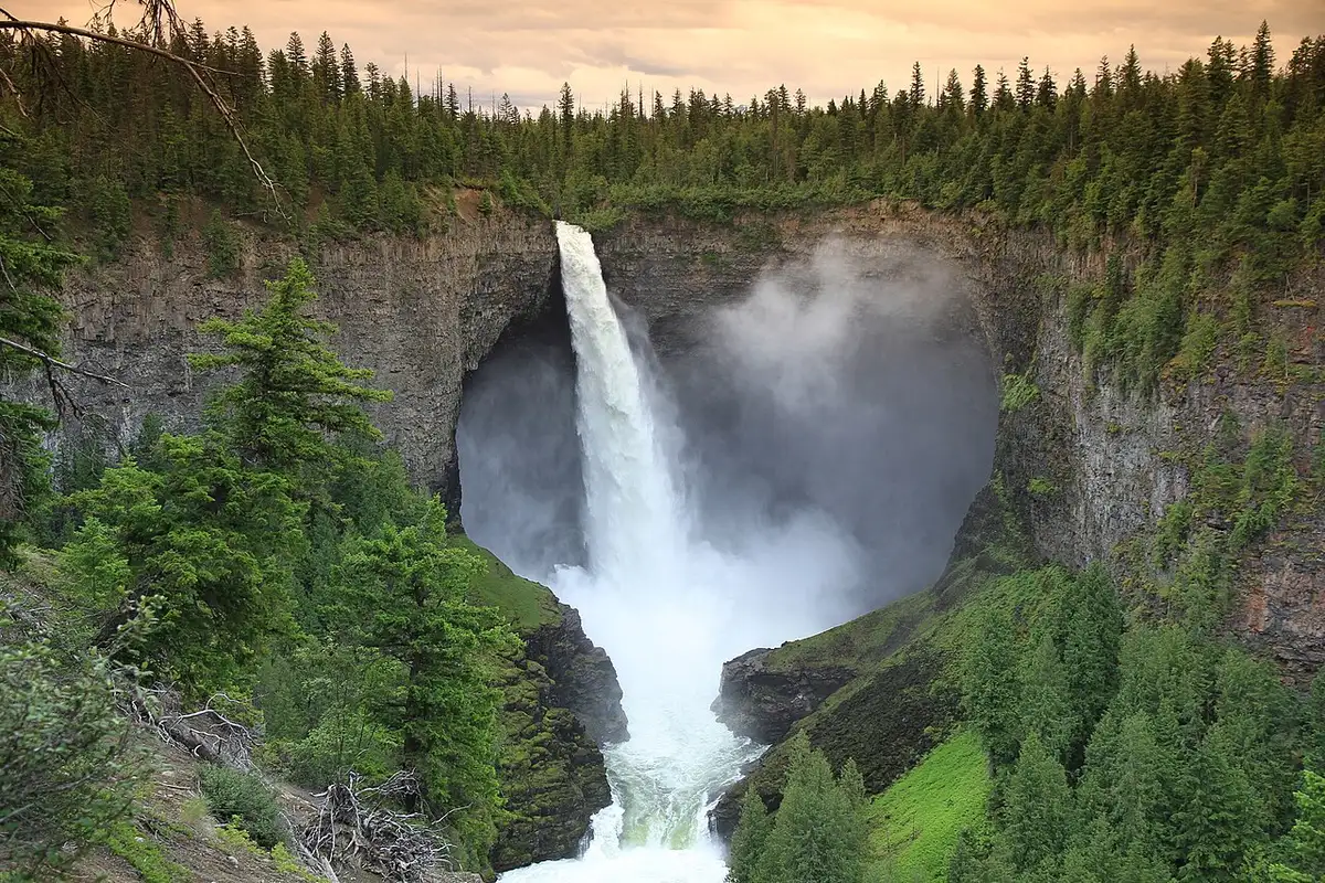
The road to Helmcken is open year-round. That’s the sentence that separates this park from half the mountain parks in B.C. In winter some of the lower-corridor lots aren’t plowed; BC Parks’ instruction is to park where the snowplow stopped and walk. In summer you drive to the viewpoint like everyone else.
The number on the corridor page is 145 metres, and the same paragraph calls Helmcken the fourth-largest waterfall in Canada. The water has cut through layers of lava. You will hear it before the railing appears.
There is a second way to see it, and BC Parks warns you in the same breath. The South Rim trail is 8 km, the view is from the edge of the canyon, there is no fence, and the ground can be slippery. If heights bother you, this is not your walk. If they don’t, it’s still a walk that needs decent shoes and enough sense not to lean on a lava lip for a photo.
The upper corridor is a different season. The road to Clearwater Lake - 71 km from Highway 5, 43 paved and 28 gravel - shuts mid-December to mid-May. Rainbow Falls, at the east end of Azure Lake, is a shoreline trail from a boat, not a highway stop. Don’t build a July plan around a January road, or a January plan around Azure Lake.
No gate fee, camping, and the $20 if you’re not from B.C.
Wells Gray is a provincial park. The Canada Strong Pass does nothing here. BC Parks does not publish a day-use admission price on the Wells Gray page, and Wells Gray is not on the timed day-use-pass list that catches people at Joffre and Garibaldi. You can look at Helmcken without buying a park ticket. You cannot camp without paying.
Nightly frontcountry rates are campground-specific and seasonal. BC Parks sends you to camping.bcparks.ca and the recreation user fee schedule rather than printing one number on the park page. What is printed, and what applies in 2026:
- Wells Gray is on the list of high-use frontcountry parks whose peak-season rates run 15 June to Labour Day.
- If you don’t live in B.C., a C$20 non-resident fee sits on top of the base camping fee for stays that start on or after 15 May 2026. It applies to reservations, first-come sites, cabins, moorage and dock use. It does not apply to children or youth. Staff can ask for a BC Driver’s Licence, BC Services Card or BCID. No proof, you pay in the park even if the website didn’t add it.
- Booking online adds a C$6 per night transaction fee per campsite, capped at C$18, plus tax. The call centre adds C$5. First-come, first-served has no transaction fee.
- Backcountry in Wells Gray is C$5 per person per night, children under 6 free.
Pets are welcome on a leash in the frontcountry, which BC Parks defines as anywhere within 1 km of a highway or park road. They’re not allowed on beaches or in most buildings. Drones without permission are illegal. None of that is optional small print.
When the upper road shuts
Winter in Wells Gray is not “closed.” It’s smaller. BC Parks still offers sightseeing at Helmcken and Dawson, with limited parking. Cross-country tracks at Majerus Farm and Stillwater Road are no longer groomed. Trophy Mountain is backcountry ski terrain, which means avalanche country and an Avalanche Canada forecast, not a packed trail. Snowmobiles are not allowed unless you have a special exception.
The seasonal cut that actually changes a road-trip plan is the mid-December to mid-May closure of the Clearwater Lake / upper-corridor road. If your picture of the park is lakes and a boat launch, you’re in a May-to-November park. If your picture is Helmcken from the viewpoint, you can come in February, park where it’s plowed, and walk.
Murtle Lake is another park entirely in practical terms: 27 km of gravel west from Blue River, then a 2.5 km trail to a canoe launch, motors banned. It’s not on the Clearwater corridor, and it isn’t a waterfall afternoon.
Two hours, a day, or a night
Two hours off Highway 5: drive 10 km to Spahats, walk to the platform, turn around. You’ve seen a canyon cut through lava and you can still make Kamloops for dinner. That’s the honest minimum, and it’s enough to know whether you want the rest.
A day: Spahats, Dawson, Helmcken viewpoint, Bailey’s Chute if the salmon month matches. Skip the South Rim unless you’ve got the legs and the head for an unfenced edge. Eat in Clearwater. Don’t start the 71 km to the lake unless you’re staying.
A night: book a corridor campground on camping.bcparks.ca, budget the C$20 if your licence isn’t B.C., and keep the next morning for Moul or the rim. A second night only pays if the upper road is open and you want Clearwater Lake.
The car is what makes any of those three versions possible. Winter tires if you’re here between October and April - the B.C. rulebook is in renting a car in Canada - and fill the tank in Clearwater. The park will not do it for you.
On the map
The map loads on click - to keep the page lightweight.
The map didn’t load. Check your connection and refresh the page.
Admission and opening hours
- Admission price
- BC Parks does not publish a day-use admission fee on the Wells Gray park page. Camping fees vary by campground and season on camping.bcparks.ca; Wells Gray is on the 2026 high-use list (peak rates 15 June to Labour Day). Non-residents of B.C. pay an extra C$20 on camping stays from 15 May 2026. Backcountry camping C$5 per person per night, children under 6 free. Phone reservation changes C$5.
- Opening hours
- The road to Helmcken Falls is open year-round; some lower-corridor parking is unusable in winter (park and walk from a plowed lot). The road to Clearwater Lake and the upper corridor is closed mid-December to mid-May. Check the trail conditions report before you go.
Facts from BC Parks pages, checked 15 August 2026. Trail conditions and campground rates change - confirm on bcparks.ca and camping.bcparks.ca.
Details checked: August 15, 2026
Read also

National parks · 11 min read
Point Pelee: Birding, Monarchs and Canada's Southern Tip
Verified · August 29, 2026Point Pelee in practice: the shuttle to the Tip, monarch season timing, Festival of Birds dates, 2026 fees, and why free admission ended before the peak.

National parks · 8 min read
Kluane: Icefields, Flightseeing and Mount Logan
Verified · August 28, 2026Kluane National Park 2026: Kathleen Lake trails, C$30 camping, Rocking Star flights from C$250, and Mount Logan at 5,959 m.

National parks · 7 min read
Riding Mountain National Park: Bison, Clear Lake & Highlands
Verified · August 27, 2026Riding Mountain in 2026: Lake Audy bison from your car, Clear Lake beaches, Wasagaming camping fees and the drive from Winnipeg.

National parks · 8 min read
La Mauricie National Park 2026: Parkway, Lakes & Camping
Verified · August 26, 2026La Mauricie NP: two hours from Montreal or Quebec City. 2026 gate C$10, 64 km Parkway, camping from C$33.75, Navette Nature shuttles.