British Columbia Travel Guide: The Five Trips
British Columbia is bigger than France and Germany combined: the five realistic trips, how many days each needs, the ferry to the island and when to go.
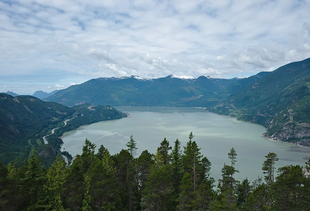
British Columbia is where the Pacific meets the mountains, and it’s far too big for a single visit. The province covers 944,735 km2, larger than France and Germany combined, which is the fact most guides quietly skip: you can’t fit Tofino, the Okanagan and the BC Rockies into one week, and pretending you can is how a vacation turns into a driving marathon. Pick one of five regions, give it the days it needs, and BC pays you back.
One correction up front, because it redraws the map in your head. The capital is Victoria, on Vancouver Island, not Vancouver on the mainland. Getting between the two means a ferry or a floatplane rather than a short drive, and that single fact undoes any plan that treats them as neighbours a bus ride apart.
How big British Columbia really is
The distances are the trip planner, so start with them. Everything below hangs off Vancouver, and the times are realistic rather than optimistic.
| From Vancouver | To | Roughly |
|---|---|---|
| Sea to Sky Highway | Whistler | 127 km, allow half a day with stops |
| Ferry, then road | Victoria | 1 h 35 min crossing plus terminal time |
| Ferry, then Highway 4 | Tofino | a full day, about 3 h past Nanaimo |
| Highway 5 and 97 | Kelowna (Okanagan) | about 390 km |
| Highway 1 east | Yoho and the BC Rockies | a full day, this is its own trip |
The lesson in the table is that BC isn’t a hub with day trips. It’s five separate trips that happen to share a provincial flag, and the ferry to the island alone can eat half a day each way.
The five trips inside British Columbia
Vancouver and the Sea to Sky corridor
The obvious first visit, and the easiest. Vancouver itself needs three or four days, and the Sea to Sky Highway north to Whistler is one of the great short drives in the country, passing Shannon Falls and the granite dome of the Stawamus Chief on the way. It works as a long day trip or an overnight, and in summer the gondola at Squamish breaks the drive neatly. This is the region that pairs with a first-timer’s flight into Vancouver, and where our where-to-stay guide does the most work. For Bike Park and PEAK 2 PEAK summer pricing, see Whistler in summer after the Whistler travel guide; the Peak 2 Peak Gondola page breaks the ride down by season, and where to stay in Whistler covers the Village, Upper Village and Creekside if you’re staying more than a day.
Victoria and southern Vancouver Island
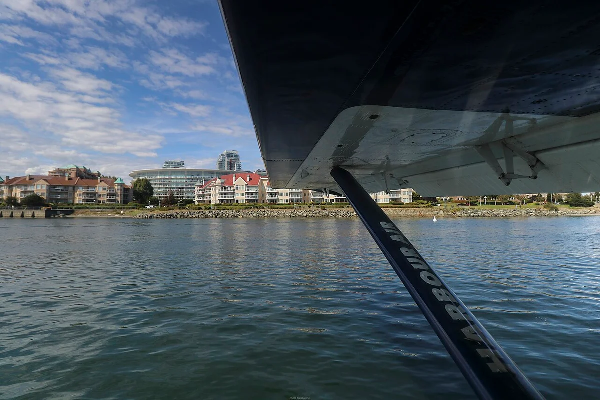
Cross to the island and the pace drops. Victoria has the Inner Harbour, the floatplanes and, fifteen minutes out, the Butchart Gardens, where summer 2026 adult entry is C$44.25 with tax included. Give it two days minimum once you count the ferry, which runs Tsawwassen to Swartz Bay in 1 h 35 min before you even reach the city. The Vancouver to Victoria transport guide lays out ferry, floatplane and coach options if you are planning the crossing from the mainland.
Tofino and the Pacific Rim coast
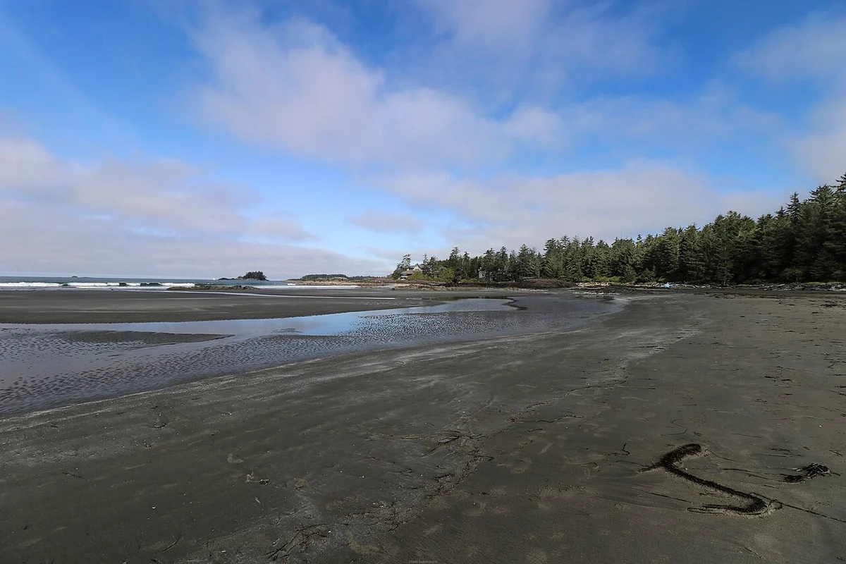
The wild side of the island, and the longest reach. Tofino and the Pacific Rim National Park Reserve sit about three hours past the Nanaimo ferry on Highway 4, and the payoff is the open Pacific: surf beaches in summer and, from November to February, storm-watching, when swells that started near Japan hit Long Beach with nothing in the way.
The Okanagan: lakes, wine and the dry side of BC
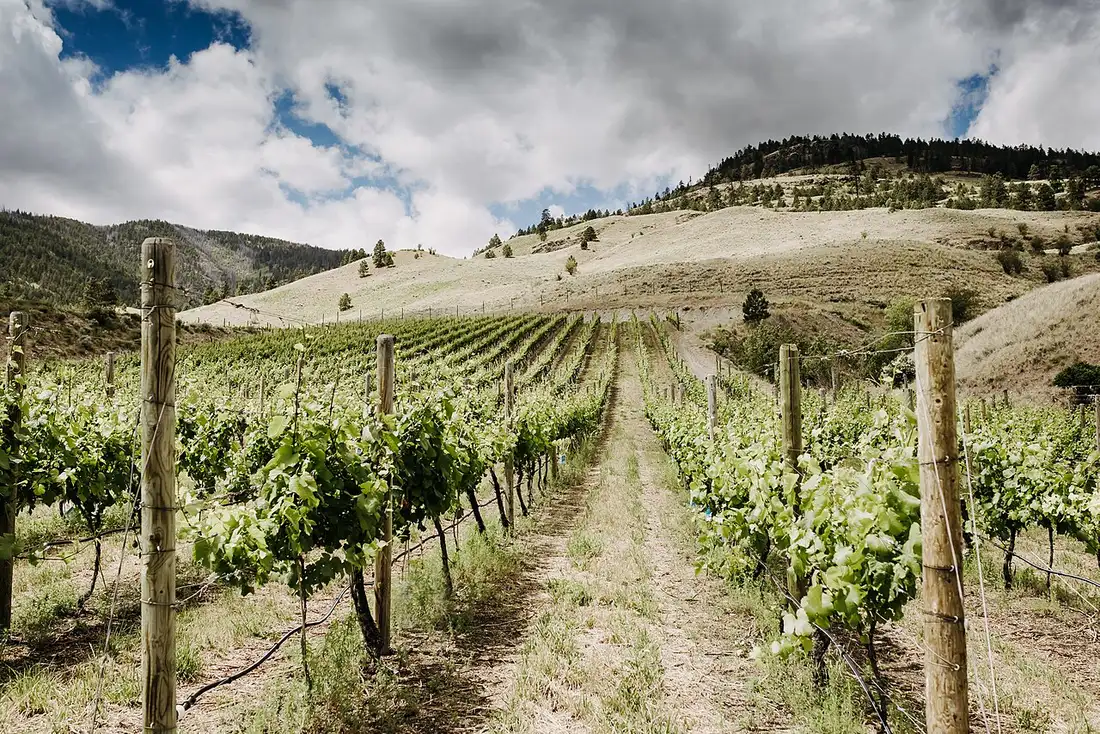
Inland and utterly different. The Okanagan Valley around Kelowna is the province’s fruit basket and its wine country, holding about 196 of BC’s 277 wineries along a string of warm lakes. While Tofino is fogged in, the Okanagan can be dry and hot, which is exactly why locals drive four hours east for it. Budget three or four days if wine is the point - our Okanagan Valley guide has the wineries, towns and where to base yourself.
The BC Rockies: Yoho, Kootenay, Glacier and Mount Revelstoke
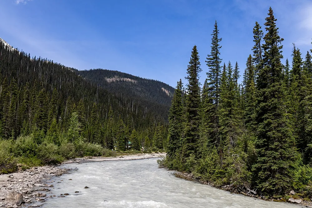
Here’s the correction that matters most. Banff and Jasper are in Alberta, not BC. British Columbia’s mountain parks are Yoho, Kootenay, Glacier and Mount Revelstoke, and they sit right against the Alberta boundary, so people muddle them constantly. Yoho holds Emerald Lake and Takakkaw Falls, one of the highest waterfalls in Canada, both a short detour off the Trans-Canada near Field.
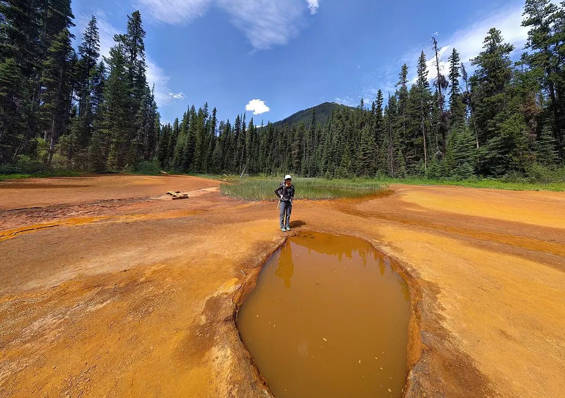
Kootenay adds the ochre Paint Pots and Radium Hot Springs (our Kootenay National Park guide covers the road, the closures and the hot springs booking rules), and Glacier and Mount Revelstoke sit on the Trans-Canada between Golden and Revelstoke - most through-traffic skips them, which is why we wrote a dedicated Revelstoke and Glacier parks guide. Because these parks border Banff, the neat move is to fold them into a Rockies trip rather than treat them as a separate BC visit. Our Canadian Rockies road trip and the Icefields Parkway both run through the same corner, and the Alberta guide covers the other half of it.
How many days do you need
Five days buys Vancouver plus one add-on: the Sea to Sky corridor, or a first trip across to Victoria, but not both comfortably. Seven to ten days is enough for Vancouver and Vancouver Island together, ferry time included, or Vancouver plus the Okanagan. Fourteen days is the one that reaches from the coast to the Rockies, and even then it moves. The mistake is trying to compress the fourteen-day version into seven - if you’re stuck choosing Island vs Banff-Jasper for a single week, use Canadian Rockies vs Vancouver Island.
When to visit British Columbia
Summer (June to September) is peak: everything open, the island and Okanagan at their best, and the highest prices and ferry queues. May and October are the quiet shoulders, green and cheap, with cooler water. Winter splits in two: world-class skiing at Whistler and Revelstoke, storm-watching at Tofino, and a driving rule that catches visitors out.
Winter tires or chains are required on most designated routes from 1 October to 30 April, and the fine is C$121. The Sea to Sky Highway up to Whistler is one of the routes on the shorter calendar instead, 1 October to 31 March. Most rentals in BC come on M+S tires that meet the minimum, but ask before you drive off, because the rules differ sharply from province to province. Our guide to renting a car in Canada lays out the three separate winter-tire rulebooks.
Parks and passes: what you actually pay
Two systems overlap here, and mixing them up costs a day. National parks such as Pacific Rim, Yoho and Kootenay run on Parks Canada fees, and the Canada Strong Pass made admission free for everyone from 19 June to 7 September 2026; from 8 September 2026 the usual Parks Canada fees apply again, so put the gate fee in the budget.
Provincial parks are separate and, at the busiest spots, need a free BC Parks day-use pass booked in advance. Not every park uses that pass: Wells Gray off Highway 5 at Clearwater is a waterfall corridor with no day-use fee on the park page - you pay when you camp.
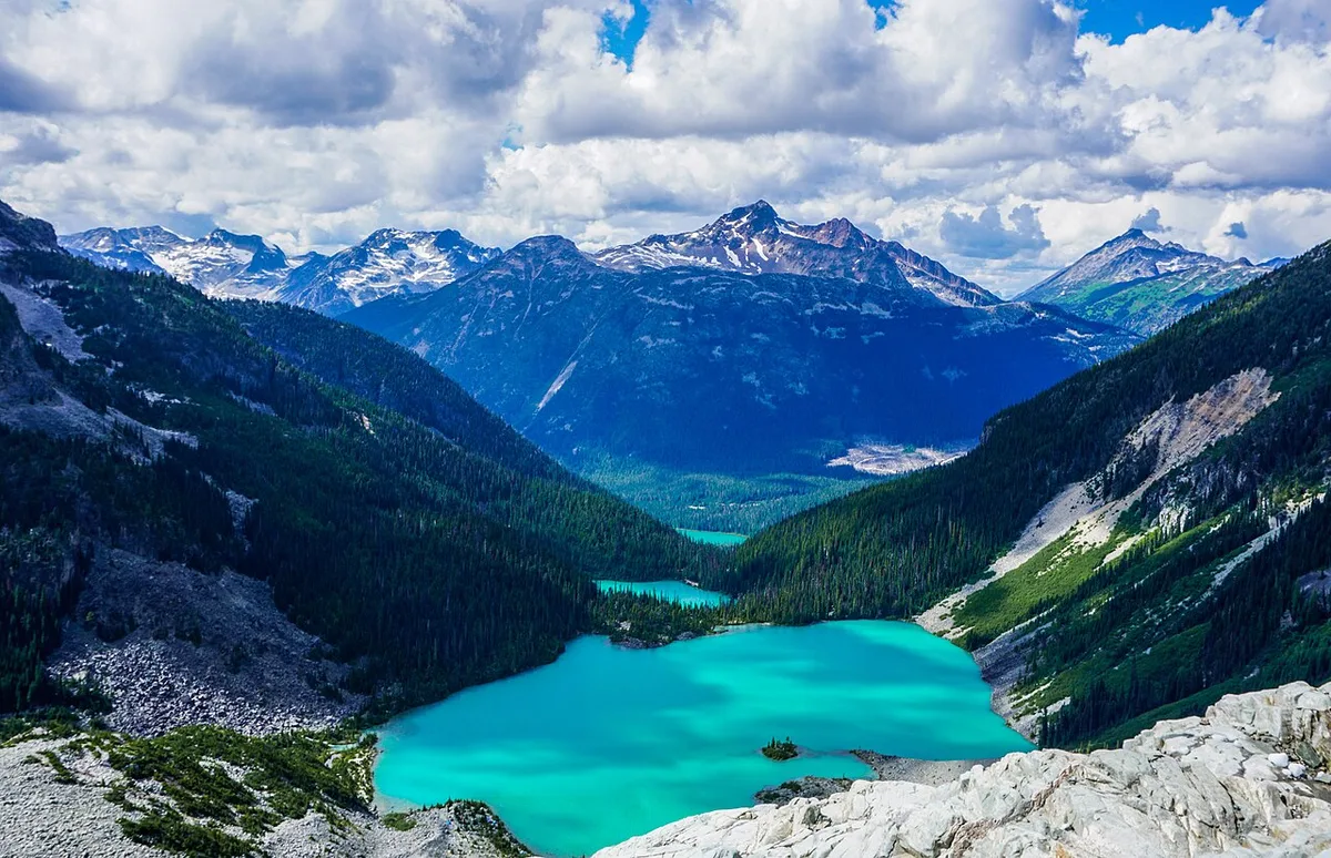
Joffre Lakes needs one from 11 May to 25 October, Garibaldi from 12 June to 12 October, and Golden Ears on summer weekends. Passes are released two days ahead at 7 am Pacific and go fast. This is the single most common way visitors get caught: they drive two hours to a parking lot they can’t legally use.
Getting around
Driving is the default, and the distances above are the reason. BC Ferries links the mainland to Vancouver Island, with the main Tsawwassen to Swartz Bay run costing from C$49 to C$99 for a car and driver on Saver fares, C$15 on foot, plus a 5% fuel surcharge. Floatplanes are the fast alternative, downtown to downtown between Vancouver and Victoria in about half an hour, and a genuine sight in themselves.
Practical questions before you go
Bears are real and mostly a food-storage problem rather than a danger; follow posted rules on the coast and in the Rockies alike. Mobile coverage is good in the corridors and gone the moment you leave them. On entry rules, whether you need a visa or an eTA depends on your nationality, and those rules change, so check the official source at travel.gc.ca before you book rather than trusting a guide. Everything else, from tipping to weather, BC shares with the rest of Canada.
Read also
- The city most trips start from: things to do in Vancouver
- Where to base yourself there: where to stay in Vancouver
- The Rockies that spill over from Alberta: Canadian Rockies in 7 days
- Calgary to Vancouver with the Okanagan in the middle: Western Canada in 10 days
- The province on the other side of the mountains: Alberta travel guide
- Winter tires and one-way fees: renting a car in Canada
On the map
The map loads on click - to keep the page lightweight.
The map didn’t load. Check your connection and refresh the page.
Read also

Provinces · 12 min read
Alberta Travel Guide: What to See and How Long
Updated · September 14, 2026Alberta beyond the Rockies: six UNESCO sites, the badlands, park fees after the 2026 free-entry window, the pass rental cars still need, and when to go.

Provinces · 10 min read
Manitoba Travel Guide: Bears, Belugas and Winnipeg
Updated · July 24, 2026Why Manitoba is two trips: walkable Winnipeg and the Forks, and Churchill, the fly-in north for polar bears, belugas and the northern lights.

Provinces · 8 min read
New Brunswick Travel Guide: Fundy and Two Tongues
Updated · September 14, 2026New Brunswick, the Bay of Fundy province: Hopewell Rocks and record tides, Saint John, Fredericton and Canada's only bilingual province.

Provinces · 9 min read
Newfoundland and Labrador Travel Guide
Updated · September 14, 2026Newfoundland and Labrador in 7 to 10 days: St. John's, Gros Morne's mantle rock, the Vikings at L'Anse aux Meadows, icebergs and whales.