New Brunswick Travel Guide: Fundy and Two Tongues
New Brunswick, the Bay of Fundy province: Hopewell Rocks and record tides, Saint John, Fredericton and Canada's only bilingual province.
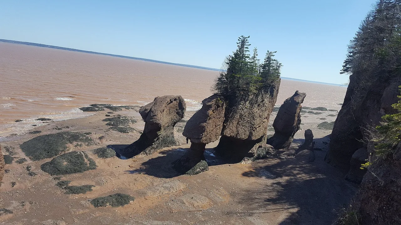
New Brunswick is the Bay of Fundy province, and the Bay of Fundy has the highest tides in the world - a title the remote Ungava Bay in northern Quebec now also claims. The water here rises and falls up to about 12 m or more twice a day, and the way to feel it’s at the Hopewell Rocks: walk out on the sea floor among towering flowerpot stacks at low tide, then come back six hours later and kayak over the exact same spot. Four to six days covers the Fundy coast, the two small cities of Saint John and Fredericton, and the French-speaking Acadian shore. It’s also Canada’s only officially bilingual province, so road signs, menus and greetings arrive in both English and French.
The tide is the clock the whole trip runs on. It swings on a cycle of a little over twelve hours, which means the flowerpots you walked between in the morning are underwater by mid-afternoon, and the mud flats reappear again after dark. Plan the headline sights around the daily tide table rather than the other way round, and the province suddenly makes sense.
How many days you need
Four days is enough for the Fundy loop: the Hopewell Rocks, Fundy National Park at Alma, and a night each in Saint John and Fredericton. Six days adds the Acadian northeast - Caraquet and the warm beaches of the Northumberland Strait - or a slower run along the coast. New Brunswick is the land bridge to the rest of the Maritimes, so most people pass through it on the way to somewhere: it sits between Quebec and Nova Scotia, and the Confederation Bridge to Prince Edward Island launches from its shore.
The Bay of Fundy
Parks Canada’s careful wording for the bay is “up to 12 m or more,” and that’s the number to keep in your head for the New Brunswick side; the outright records, up near 16 m, belong to the Nova Scotia end. What matters isn’t the record but the swing, and how much of the shore it uncovers and drowns twice a day. That churn is also what feeds the bay, and it’s why up to a dozen whale species spend the summer here, watched from boats out of St Andrews and Grand Manan. A Fundy ticket is roughly half the price of a Pacific one, for reasons whale watching in Canada works through.
Hopewell Rocks
The Hopewell Rocks are the set piece: sandstone sea stacks 12 to 21 m tall, carved by the tides and topped with a scruff of spruce, so they look like flowerpots on stems. At low tide you walk out on the ocean floor and crane up at them; at high tide, six hours later, the water is deep enough to paddle a kayak around their crowns.
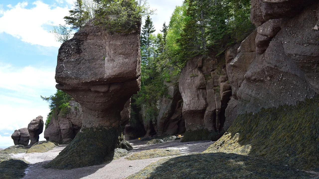
One practical thing changes how you plan: park admission is valid for two consecutive days, precisely so you can come back and catch the opposite tide. The interpretive site is seasonal with staffed hours; 2026 ticket prices, ocean-floor access windows and a worked tide-table example live on the Hopewell Rocks guide, and you should still re-check the live NB Parks tide table before you pick your morning.
Fundy National Park and Alma
At the fishing village of Alma, Fundy National Park protects a stretch of Acadian forest that spills down to the same tidal shore, with waterfalls, the ocean floor at low tide, and rooms and lobster suppers in the village. Under the Canada Strong Pass, admission was free from 19 June to 7 September 2026, with 25% off Parks Canada camping; from 8 September 2026 the standard fees apply again.
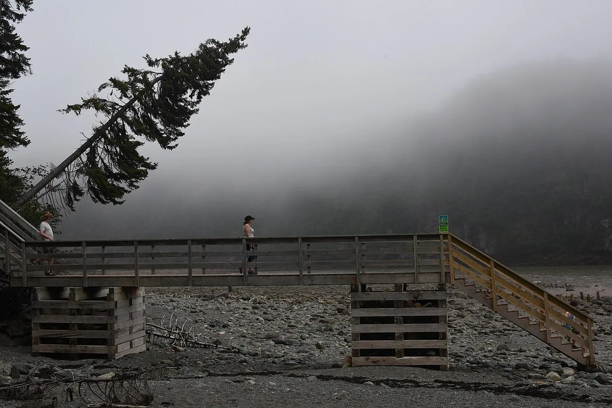
One 2026 catch worth flagging: the park’s photogenic Point Wolfe Covered Bridge closes for repairs from 8 September through December 2026, so it’s open through the summer but gone for the fall - check the park page before you build a day around driving to it.
Saint John and the Reversing Rapids
Saint John, the province’s gritty port city, has the bay’s cleverest trick. Where the Saint John River meets the sea, a narrow rock gorge produces the Reversing Falls, better called the Reversing Rapids: twice a day the incoming Fundy tide climbs high enough to overpower the river and force the rapids to run backwards, upstream. It’s not a waterfall flowing in reverse, whatever the postcards say - it’s a set of tidal rapids that changes direction, and the show is at the turn of the tide, not at slack water.
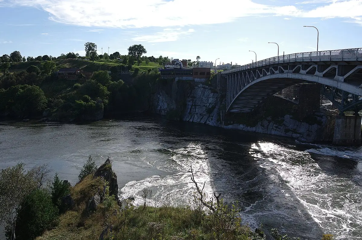
Uptown, the covered Saint John City Market - long billed as one of the oldest continuously running farmers’ markets in Canada - and the steep Loyalist-era streets are worth an afternoon on either side of the tide. You’ll want both.
Fredericton, the capital
Inland on the river, Fredericton is the quiet counterweight: the seat of government and the university town rather than the industrial port. The draws are the Beaverbrook Art Gallery, a small but serious collection with works well above the weight of a city this size, and the Historic Garrison District, the old British military grounds where a changing of the guard runs in summer. Add Christ Church Cathedral, the leafy riverfront trail and the Saturday farmers’ market and you’ve got a gentle day or two. It also makes the natural first or last stop for anyone driving in from Quebec or Maine. West of the city, near Hartland, stands the world’s longest covered bridge, about 390 m of weathered timber over the Saint John River.
The Acadian coast and a bilingual province
The second big reason to come is cultural - that’s the one most visitors under-budget for. New Brunswick is the only officially bilingual province in Canada - the distinction matters, because federally the whole country is bilingual and Quebec’s sole official language is French, but at the provincial level New Brunswick alone gives English and French equal legal footing. That was set by the province’s Official Languages Act in 1969 and locked into the Canadian Charter of Rights and Freedoms in 1982.
About 233,000 New Brunswickers speak French as a mother tongue, the majority of them Acadians, whose ancestors the British began deporting in 1755 in the upheaval known as le Grand Dérangement. Many came back, and their culture is centred on the northeastern Acadian Peninsula around Caraquet, with its own flag, its own accordion-driven music and the joyful racket of Tintamarre on National Acadian Day, 15 August.
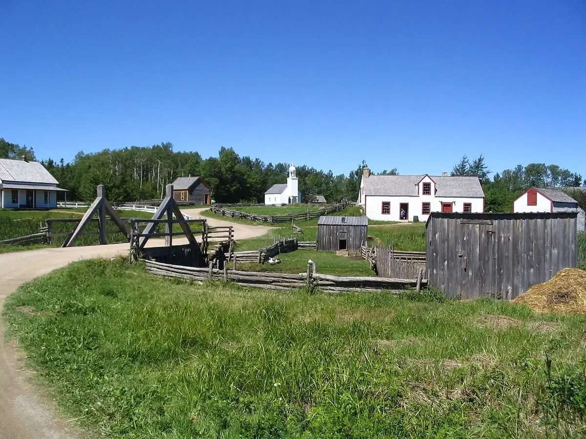
The northeast has one more surprise for anyone who has only felt the cold Fundy water: the Northumberland Strait side is genuinely warm for a swim, and Kouchibouguac National Park protects lagoon beaches and dunes along it - the opposite experience to the tide-scoured Fundy shore an hour or two south.
When to go and getting around
Summer, roughly late June to early September, is the season: the interpretive sites are open, the water on the strait is warm, and 15 August brings the Acadian celebrations to the northeast. September is quieter and cooler, with the Fundy fog easing. Whatever the month, the daily tide table matters more here than the weather forecast - don’t bother with Hopewell Rocks or the Reversing Rapids if you haven’t timed them.
You need a car; the sights are spread along the coast and inland rivers with little transit between them. If you’re stitching the Maritimes together, our guide to renting a car in Canada covers drop fees, and the food guide sorts out where the lobster suppers and fiddleheads fit.
Read also
- The other Bay of Fundy shore and its record tides: Nova Scotia travel guide
- The island the Confederation Bridge reaches: Prince Edward Island travel guide
- What to order on the coast: Canadian food, what to try
- Every province and territory: the provinces hub
On the map
The map loads on click - to keep the page lightweight.
The map didn’t load. Check your connection and refresh the page.
Read also

Provinces · 12 min read
Alberta Travel Guide: What to See and How Long
Updated · September 14, 2026Alberta beyond the Rockies: six UNESCO sites, the badlands, park fees after the 2026 free-entry window, the pass rental cars still need, and when to go.

Provinces · 9 min read
British Columbia Travel Guide: The Five Trips
Updated · September 14, 2026British Columbia is bigger than France and Germany combined: the five realistic trips, how many days each needs, the ferry to the island and when to go.

Provinces · 10 min read
Manitoba Travel Guide: Bears, Belugas and Winnipeg
Updated · July 24, 2026Why Manitoba is two trips: walkable Winnipeg and the Forks, and Churchill, the fly-in north for polar bears, belugas and the northern lights.

Provinces · 9 min read
Newfoundland and Labrador Travel Guide
Updated · September 14, 2026Newfoundland and Labrador in 7 to 10 days: St. John's, Gros Morne's mantle rock, the Vikings at L'Anse aux Meadows, icebergs and whales.