Nova Scotia Travel Guide: The Sea and the Road
How to loop Nova Scotia in a week: Halifax and the South Shore, Cape Breton and the Cabot Trail, two UNESCO towns and the Bay of Fundy tides.
Nova Scotia is a near-island you can loop in a week: Halifax and the South Shore in three days, Cape Breton and the Cabot Trail in three or four more. It holds two UNESCO World Heritage sites, the lighthouse on the front of every second postcard from Canada, and the record-setting end of the Bay of Fundy, where the tide can rise the height of a house twice a day. Come between late September and about 23 October and you get turning leaves and thinner crowds, plus the Celtic Colours festival on Cape Breton, which ran 9 to 17 October in 2026 and is listed for 8 to 16 October in 2027.
Do not skip Cape Breton Highlands National Park on a Nova Scotia road trip.
The one thing to fix in your head before you plan is distance. Nova Scotia looks compact on a map, but Cape Breton isn’t a day trip from Halifax; the usual base for the Cabot Trail, Baddeck, sits about 300 km up the road, three hours or more each way, and the famous loop is another 298 km on top of that. Treat the province as two trips that share a licence plate, give each its own base, and the driving stops feeling like a chore.
How many days you need
Three days is enough for Halifax and the South Shore: the city, Peggy’s Cove, Lunenburg and Mahone Bay, with the Bay of Fundy shore an easy add if you have a car. Seven days is the honest minimum to add Cape Breton, which needs two or three nights of its own once you’ve driven up. Ten days lets you slow down on the Cabot Trail and swing through the French Shore around Yarmouth and the wine country of the Annapolis Valley on the way back.
The shape most people drive is a rough figure-eight out of Halifax: south and west along the coast first, then north and east to Cape Breton. Nowhere in the province is far from salt water, which is the whole point, but it also means the roads hug the shore and take longer than the kilometres suggest.
Halifax and the South Shore
Halifax is the capital, the airport and the natural base for the first half of the trip, and it has its own guide here, plus a separate breakdown of where to stay in Halifax by area. West of the city the South Shore strings together the postcard stops on a half-day’s drive, so most people do them from a Halifax base rather than moving hotels.
Lunenburg and the Bluenose
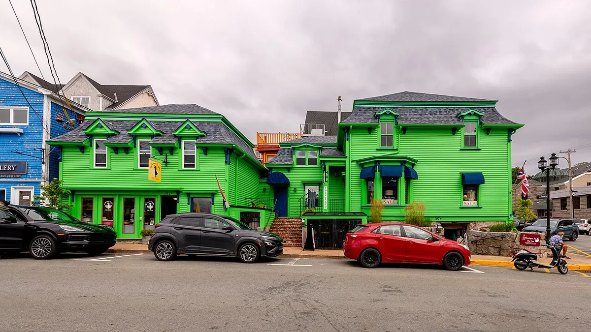
Old Town Lunenburg is one of the province’s two World Heritage sites, inscribed by UNESCO in 1995 as the best surviving example of a planned British colonial settlement in North America. Founded in 1753, it still runs on its original grid, and the steep streets are lined with the brightly painted wooden houses that make it the most photogenic town in the province. The dedicated Lunenburg city guide walks the harbour, the Fisheries Museum and Bluenose II berth.
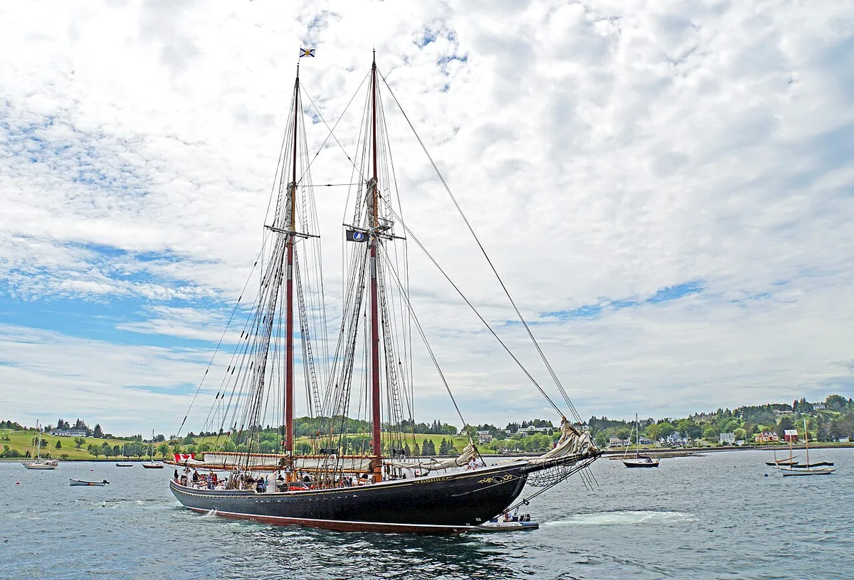
Lunenburg is also the home port of the Bluenose, the racing schooner launched here in 1921 that has been on the Canadian dime for nearly a century. One correction that trips up visitors: the black-hulled schooner you’ll see in the harbour today is Bluenose II, a replica launched in 1963 from the same yard. The original was sold south and wrecked on a reef off Haiti in 1946, so the ship in front of you is a faithful copy, not the boat on the coin.
Peggy’s Cove, and the line that isn’t optional
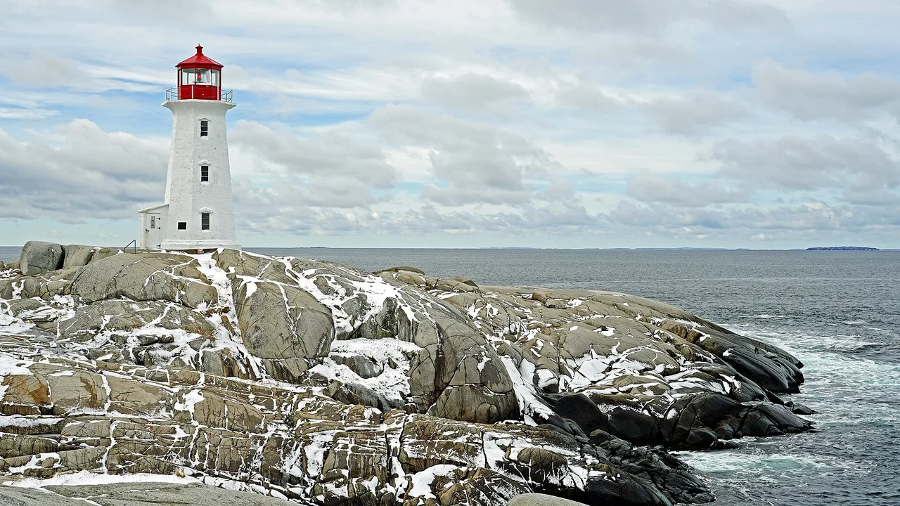
About forty-five minutes from Halifax, Peggy’s Point Lighthouse stands on a shelf of wave-polished granite, and it earns its billing as the most photographed lighthouse in Canada. The tower dates from 1915; the crowds date from about ten minutes after you arrive.
Say this part plainly, because people die here most years. The dark, wet rock closest to the surf is deadly: rogue waves sweep visitors off it without warning, and the water is cold enough to finish the job fast. The province added a raised viewing deck to keep you back, and the rule is simple - don’t step on the black rock. The dry grey granite higher up is where the photograph is anyway.
Cape Breton and the Cabot Trail
Cape Breton Island, reached across the Canso Causeway, is the reason you’ll want to give Nova Scotia a full week. The headline drive is the Cabot Trail, a 298 km loop around the northern highlands and through Cape Breton Highlands National Park, routinely ranked among the world’s great coastal roads. It’s a leg of its own, best based in Baddeck or Ingonish over two or three nights - our Cabot Trail guide runs it stop by stop, so this page just points you at it.
The park charges C$10 per adult per day; the fee was waived for everyone from 19 June to 7 September 2026 under the Canada Strong Pass and applies again from 8 September 2026. The island’s marquee week is fall: the Celtic Colours International Festival, nine days of Gaelic and Acadian music in village halls across Cape Breton, timed to the turning leaves. The 30th edition ran 9 to 17 October 2026, and the festival lists 8 to 16 October 2027 as the next (as of 19 October 2026). Book beds early for that stretch, because the small towns fill, and check celtic-colours.com before you go.
The Bay of Fundy and the Annapolis Valley
The province’s western edge faces the Bay of Fundy, which has the highest recorded tides in the world - a title the remote Ungava Bay in northern Quebec now also claims. Nova Scotia holds the record-setting end of it. At Burntcoat Head the difference between low and high water can reach up to roughly 16 m (53 ft), and the genuinely strange thing to do is walk out on the ocean floor at low tide, then watch the same ground vanish under the sea six hours later. On the Shubenacadie River you can ride the tidal bore, a wave that runs upstream as the tide turns.
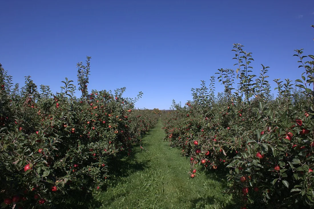
Inland from the shore, the Annapolis Valley is the warm, sheltered farm belt: apple orchards, a growing cluster of wineries, and the dyked marshland of Grand-Pré, the province’s second UNESCO site, inscribed in 2012 to commemorate the Acadians and the 1755 Deportation.
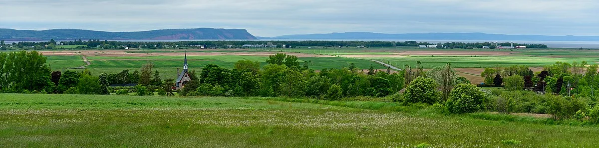
You’ll find the valley a good change of pace from the coast: a day of cellar doors, cider and orchards, with the Fundy shore hikes like Cape Split and Blomidon within reach for the afternoon.
What to eat
The table is a reason to come. Lobster is the signature: the big southwest fishery runs from the last Monday of November to 31 May, which is why the sweetest hard-shell lobster actually lands in the cold months, though menus serve it all year. Digby is scallop country, and every harbour has its own fish-and-chips. In Halifax the local obsession is the donair, the city’s official food, which we cover in the Canadian food guide rather than repeat here.
When to go
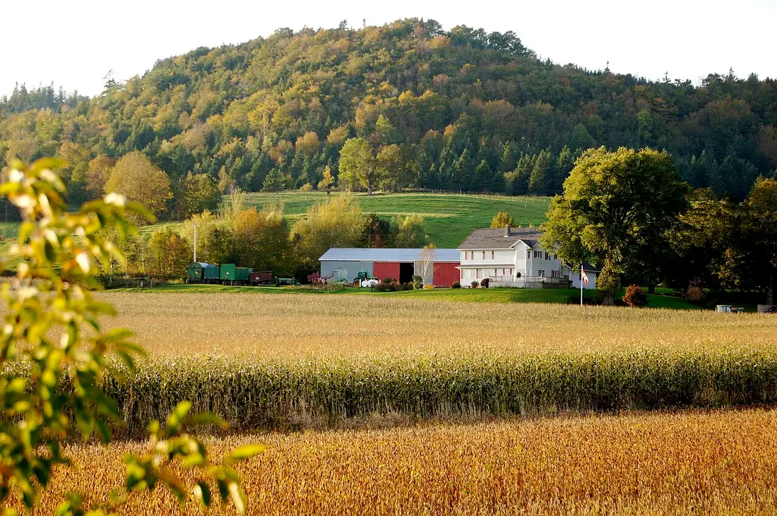
September and the first three weeks of October are the sweet spot, and it’s not close. In September the sea has had the whole summer to warm up and the crowds thin after Labour Day; then the leaves turn. Tourism Nova Scotia puts the province’s usual colour window at late September through mid-October, with Cape Breton often peaking earlier than the south, while Destination Cape Breton, the island’s own tourism organization, gives 10 to 23 October for the island. Celtic Colours (nine days in October: 9 to 17 in 2026, 8 to 16 in 2027) sits inside the province’s window, and the island’s window runs about a week past it. July and August bring the warmest air, every boat tour running and the busiest roads and highest rooms. Late spring is quiet, green and cheap, with cold water and the odd foggy stretch on the coast.
Getting there and around
Almost everyone flies into Halifax Stanfield International (YHZ), the busiest airport in Atlantic Canada, and picks up a car - transit doesn’t reach the coast, Cape Breton or the valley, so a car is effectively required. Bus 320, taxis and rideshare from the terminal are spelled out in Halifax airport to downtown. Our guide to renting a car in Canada covers the drop fees and winter rules if you’re combining provinces.
Nova Scotia joins the rest of the country only by the narrow Chignecto Isthmus, so it pairs naturally with its neighbours: New Brunswick and its Bay of Fundy shore to the west, Prince Edward Island a bridge or ferry away, and Newfoundland and Labrador reached by the Marine Atlantic ferry that sails from North Sydney, on Cape Breton, with St. John’s at the far end of the island run.
Read also
- The capital and the gateway: things to do in Halifax
- The island drive, stop by stop: the Cabot Trail
- The other Bay of Fundy shore: New Brunswick travel guide
- The island across the strait: Prince Edward Island travel guide
- Every province and territory: the provinces hub
On the map
The map loads on click - to keep the page lightweight.
The map didn’t load. Check your connection and refresh the page.
Read also

Provinces · 12 min read
Alberta Travel Guide: What to See and How Long
Updated · September 14, 2026Alberta beyond the Rockies: six UNESCO sites, the badlands, park fees after the 2026 free-entry window, the pass rental cars still need, and when to go.

Provinces · 9 min read
British Columbia Travel Guide: The Five Trips
Updated · September 14, 2026British Columbia is bigger than France and Germany combined: the five realistic trips, how many days each needs, the ferry to the island and when to go.

Provinces · 10 min read
Manitoba Travel Guide: Bears, Belugas and Winnipeg
Updated · July 24, 2026Why Manitoba is two trips: walkable Winnipeg and the Forks, and Churchill, the fly-in north for polar bears, belugas and the northern lights.

Provinces · 8 min read
New Brunswick Travel Guide: Fundy and Two Tongues
Updated · September 14, 2026New Brunswick, the Bay of Fundy province: Hopewell Rocks and record tides, Saint John, Fredericton and Canada's only bilingual province.