
St. John's, Newfoundland: Signal Hill and Icebergs
St. John's in two or three days: Signal Hill, the Battery, iceberg season on the Avalon, Cape Spear and George Street - plus how to arrive via Halifax.

Nowhere else in Canada do you run out of country quite like this. St. John’s sits on the far eastern edge of the Avalon, where jellybean row houses climb the hills above a working port and Signal Hill’s stone tower looks straight out at the Atlantic - and in spring, if the timing goes your way, at icebergs drifting down the coast. Give the city two or three days. A fourth buys you Cape Spear at dawn and an unhurried afternoon in Quidi Vidi.
The hills are the first thing that catches you. Downtown packs into a narrow bowl above the harbour, and almost every street seems to tilt. That geography is why the Battery’s painted cottages cling to the cliff face and why the view from Signal Hill feels like you’re hanging over the Atlantic. The longer island story lives in the Newfoundland and Labrador guide - this page is the city base.
How many days you need
Two days is enough for Signal Hill, the harbour walk, George Street and the Battery. Three days lets you add Cape Spear, Quidi Vidi and an iceberg boat trip in season without stacking everything into one long day. The historic core is walkable and steep; you only need a car for Cape Spear and the coastal lookouts outside the city. Compare rooms near the harbour on Trip.com before you commit - parking downtown is tight in summer, and you’ll want to be able to walk to dinner.
Newfoundland keeps its own clock (Newfoundland Standard Time, UTC-3:30), so your phone will look half an hour wrong until you stop fighting it.
Signal Hill and Cabot Tower
Signal Hill is the city’s high ground: a grassy headland with a wide view of the harbour, the Narrows and the open Atlantic. Parks Canada runs a visitor centre here through the season - 1 June to 9 October in 2026 - daily 10:00 to 18:00; the grounds stay open in winter, the centre does not. Admission is C$10.00 for adults and C$8.50 for seniors, with youth 17 and under free; from 19 June to 7 September 2026 the Canada Strong Pass made it free for everyone, and from 8 September 2026 the regular fees apply again. Access into Cabot Tower closes at 17:30. The grassy ramparts stay open year-round even when the centre is shut.
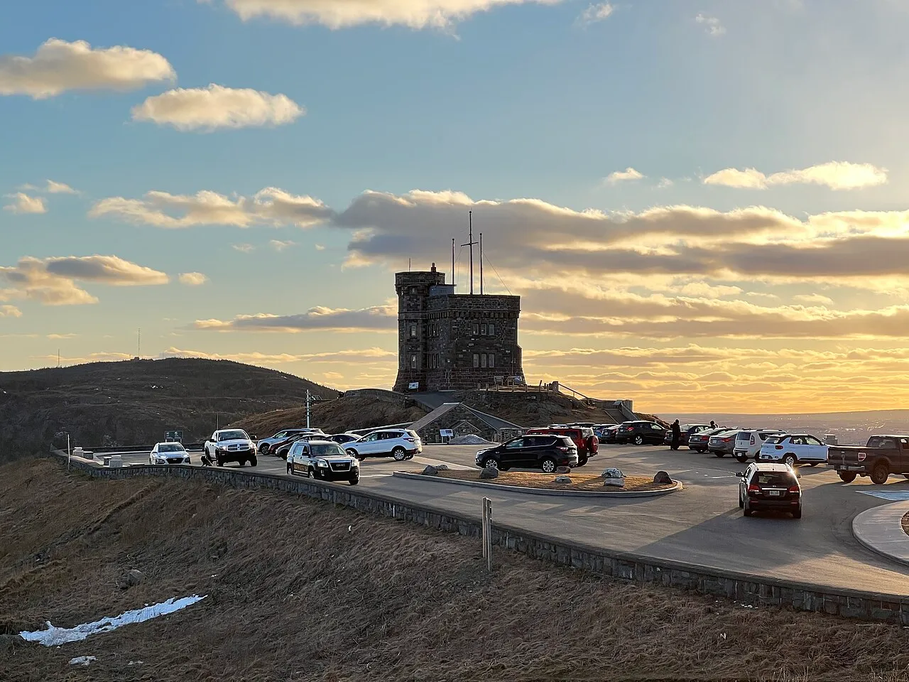
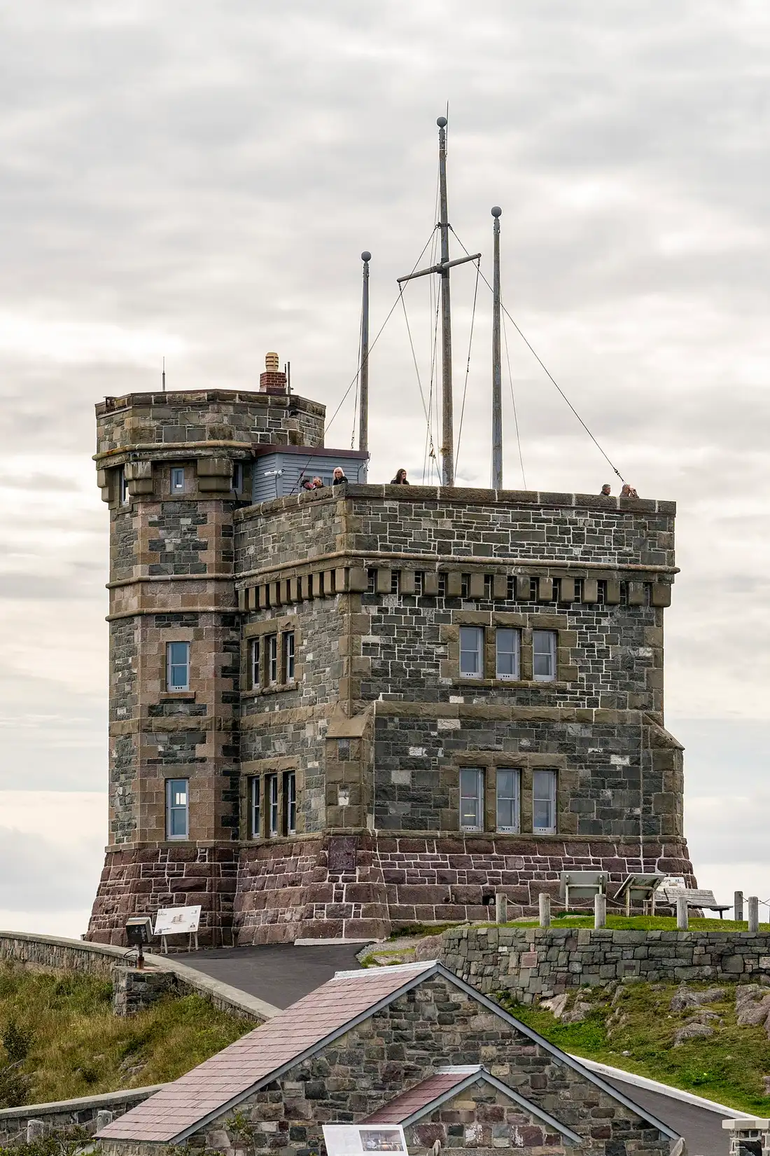
At the summit stands Cabot Tower, built between 1897 and 1900 to mark the 400th anniversary of John Cabot’s voyage and Queen Victoria’s Diamond Jubilee. It carried signal flags from 1900 but only opened officially in 1909. You can climb it when the centre is open. On a clear day you’ll see from the South Side Hills toward Cape Spear.
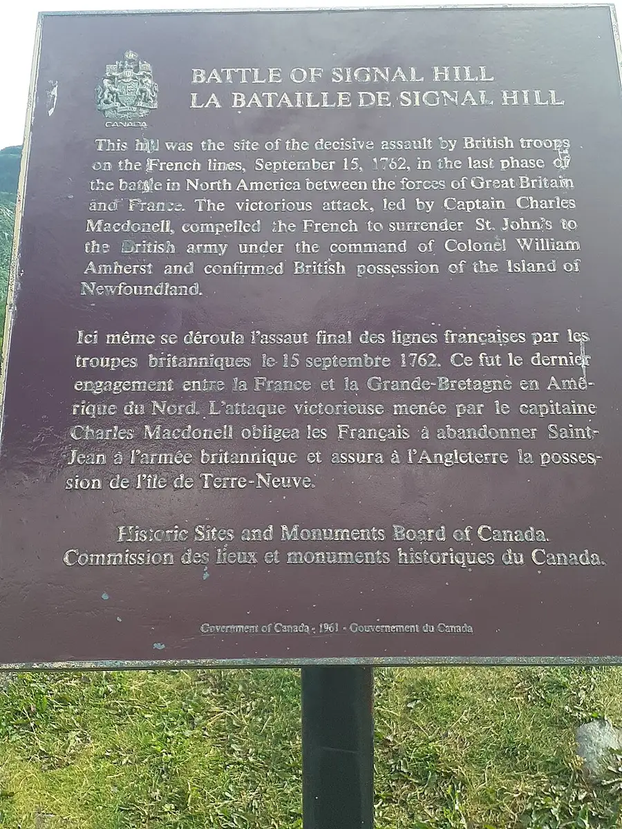
The hill has two histories worth holding apart. On 15 September 1762, British troops stormed the French lines here in the last land battle of the Seven Years’ War in North America, and the French surrender that followed confirmed British control of Newfoundland. That’s the battle the Historic Sites and Monuments Board plaque (1961) still tells in English and French. A century and a half later, on 12 December 1901, Guglielmo Marconi picked up the first transatlantic wireless signal at Signal Hill - the Morse letter S, transmitted from Poldhu in Cornwall.
The harbour and the Battery
St. John’s harbour is still a working port: fishing boats, supply vessels and the odd cruise ship share the Narrows with tour boats. You’re looking at a working harbour, not a museum quay. The walk along Harbour Drive and Water Street links downtown shops to the docks, and the whole loop is short enough to do twice in an evening if the light is good.
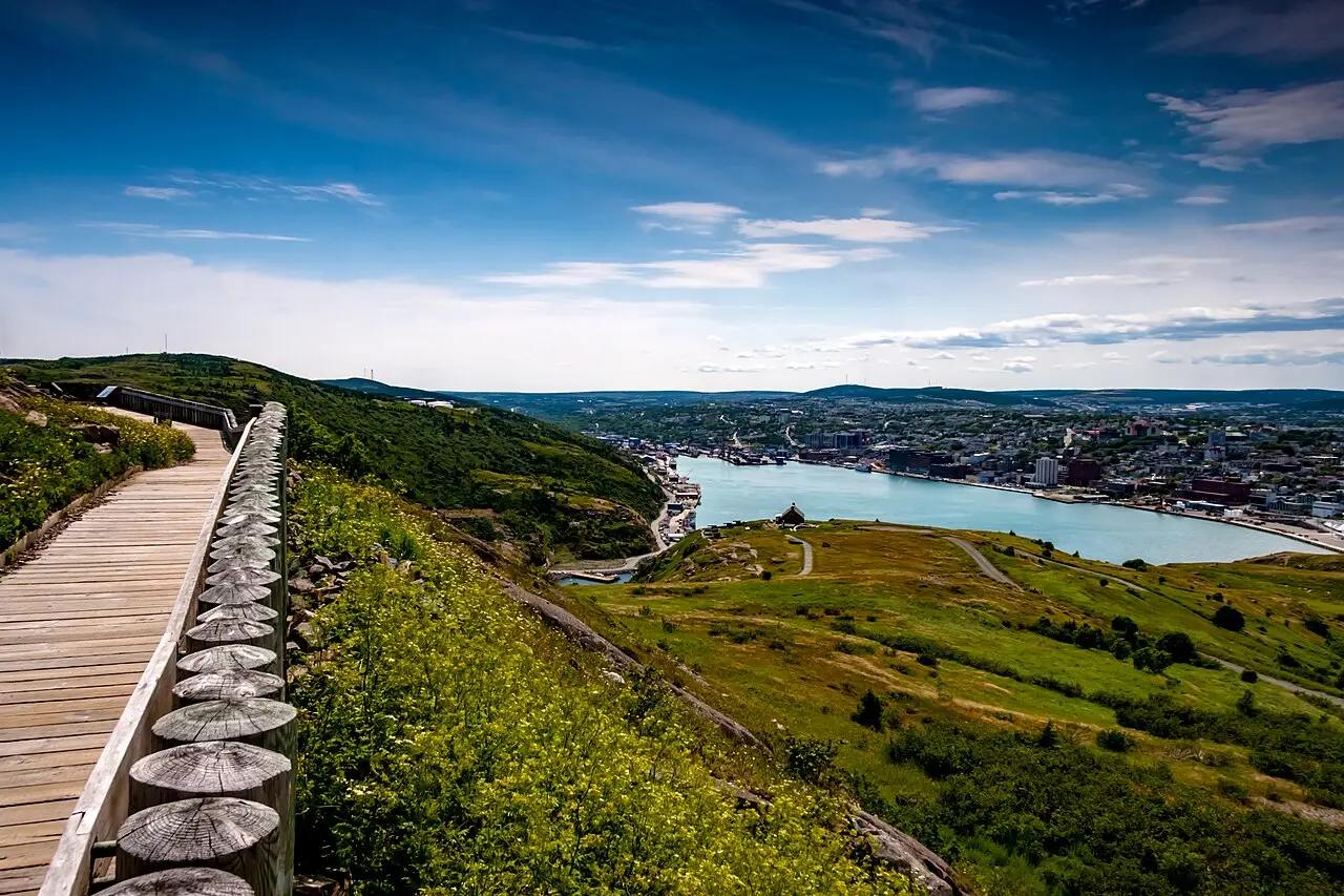
Don’t expect a polished boardwalk promenade like Halifax. This is a working waterfront that earns its keep - and that’s the point.
Below Signal Hill, the Battery is a knot of narrow lanes and brightly painted houses built into the cliff above the Narrows. It’s among the most photographed corners of the city, and the climb back up is a workout. Go at golden hour if you can.
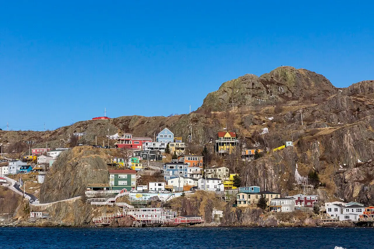

Stay on the public lanes. These are people’s homes, not a theme park.
Cape Spear
Cape Spear, about 15 km from downtown on Route 11 and 20 to 25 minutes at the wheel, is where the land runs out. Parks Canada calls it Canada’s most easterly point of land, and standing on the headland with the lighthouse behind you is the clearest sense of how far east you’ve travelled. The light has been here since September 1836 (oldest surviving lighthouse in the province), with a Second World War gun battery on the same headland. The visitor centre follows the same summer schedule as Signal Hill in 2026 - 1 June to 9 October, daily 10:00 to 18:00 - with adult admission C$10.00, and the same Canada Strong Pass free window from 19 June to 7 September 2026, with regular admission again from 8 September 2026. The grounds stay open year-round; come early for sunrise for a quieter headland.
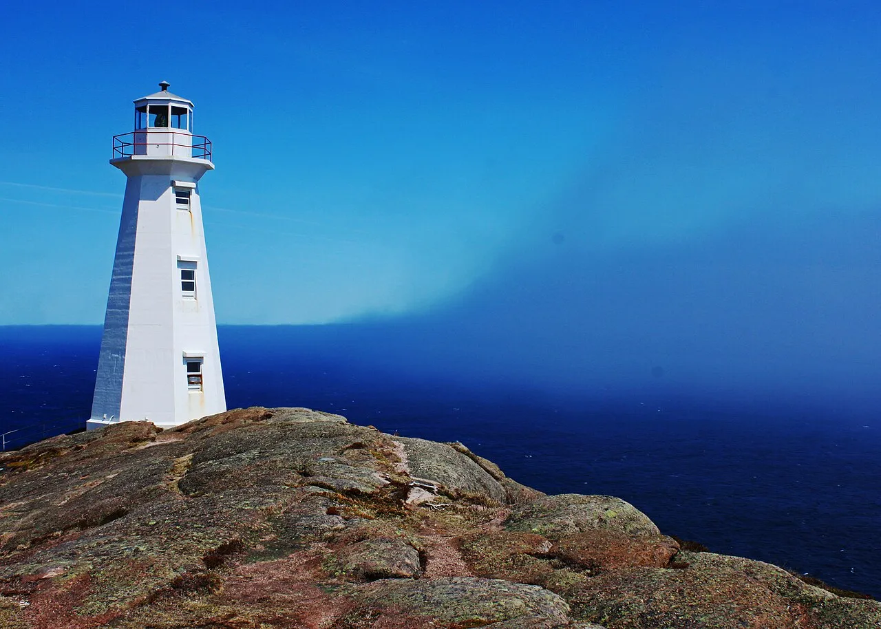
The wind here is not a joke. Bring a jacket even in July - you’ll thank yourself when fog rolls in and the temperature drops fast.
George Street and Quidi Vidi
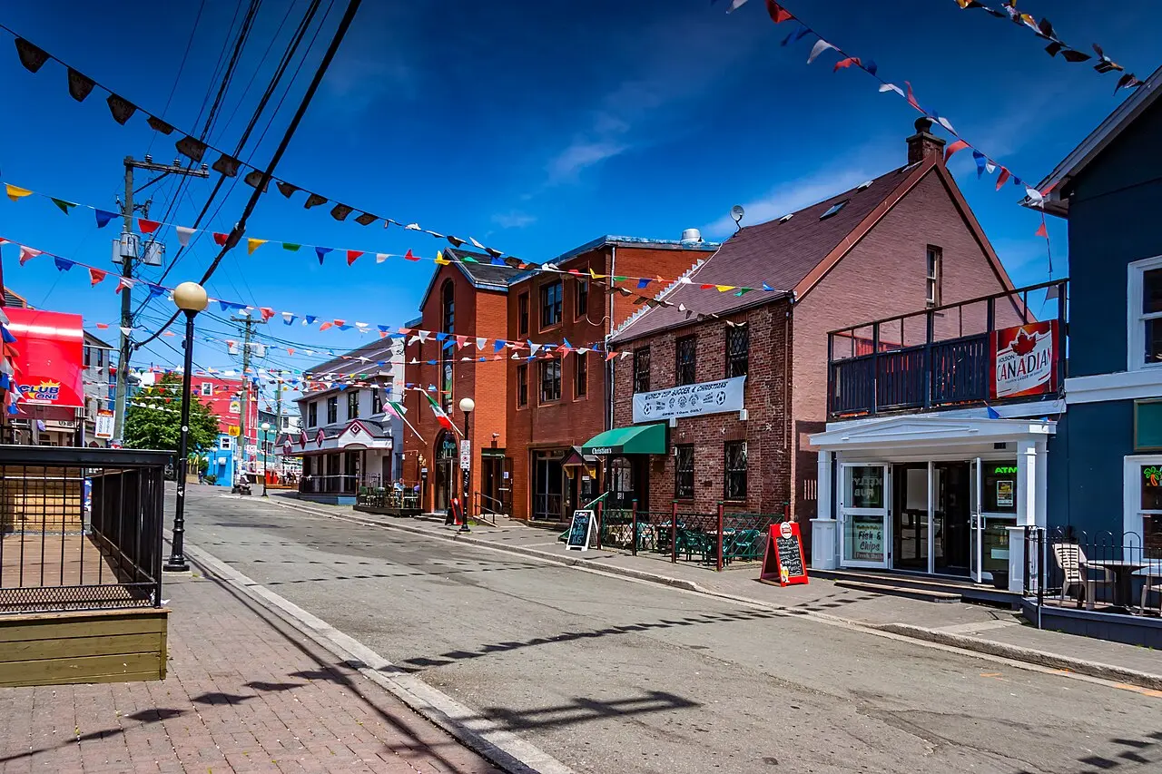
George Street is a short stretch of bars and live music in the downtown core. On summer weekends it fills after dark. If you’re not a late-night person, walk it once in the afternoon for the painted facades and save your energy for Signal Hill in the morning.
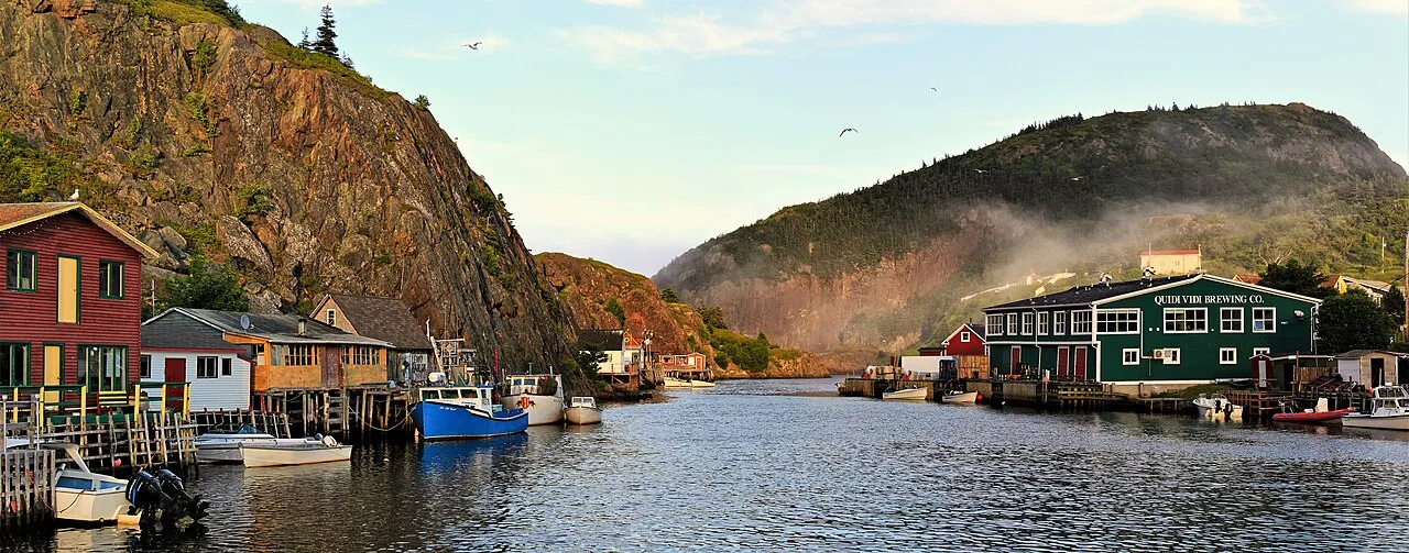
Ten minutes from downtown, Quidi Vidi is a fishing village in miniature: a tight harbour, a brewery in a restored fish plant, and a loop walk around the pond. An hour for a walk and a pint is enough.
Iceberg season on the Avalon (2026)
If you’re planning a spring 2026 trip, iceberg watching is why many visitors shift their dates to April, May or early June. Destination St. John’s (updated 4 May 2026) puts the typical Avalon window at April through June, with some seasons stretching into early July. Nothing is guaranteed - icebergs are weather and current, not a timetable - so check IcebergFinder.com the week before you fly and again when you land.
A harbour tour or dedicated iceberg boat from St. John’s gets you closer than any shoreline lookout. Book for a clear day if you can; fog kills the view faster than rain. That’s the trade: spring weather is colder and wetter than July, but it’s when the ice actually shows up off this coast.
Getting there and around
Fly into YYT (St. John’s International) for the city itself. If you’re already touring Atlantic Canada, Halifax Stanfield (YHZ) is the usual mainland hub: the flight to YYT is short, and our Halifax airport to downtown guide covers the ground side on the Nova Scotia end. For how eastern airports compare with other Canadian hubs, see which airport for Canada.
The road-and-ferry route is slower. Marine Atlantic sails from North Sydney on Cape Breton to Port aux Basques year-round (about 7 hours), or to Argentia in season (about 16.5 hours, closer to St. John’s once you drive off). That fits a Nova Scotia loop that includes Halifax and Lunenburg before you head to the island.
Downtown rewards walking despite the hills. Rent a car for Cape Spear, Quidi Vidi and any lookout outside the city limits. And if you’re continuing west: St. John’s to Gros Morne is roughly 700 km, about 7 to 8 hours - a full driving day, not a morning add-on.
Read also
- Province overview: Newfoundland and Labrador
- West-coast geology day: Gros Morne
- Nova Scotia gateway: Halifax
- UNESCO South Shore town: Lunenburg
- YHZ ground transport: Halifax airport to downtown
- Arrival airport choice: which airport for Canada
On the map
The map loads on click - to keep the page lightweight.
The map didn’t load. Check your connection and refresh the page.
Read also

Cities · 11 min read
Regina: Legislature, RCMP Heritage Centre and Prairie Base
Verified · August 29, 2026Wascana Centre, the Legislature, the Mounties' only training depot and a free T. rex - what Regina actually rewards, plus the road to Saskatoon.

Cities · 10 min read
Whitehorse: Yukon Base for Aurora, Rivers and the Klondike
Verified · August 28, 2026Whitehorse in 2026: SS Klondike grounds open but boat closed, MacBride C$12, Beringia C$6, Miles Canyon and aurora season.

Cities · 9 min read
Things to Do in Saskatoon: River Valley, Wanuskewin & Skies
Verified · August 27, 2026Saskatoon in practice: Meewasin trails, Wanuskewin bison, Remai Modern by donation, and a prairie day trip to Riding Mountain.

Cities · 9 min read
Lunenburg: UNESCO Old Town Guide
Updated · September 2, 2026Old Town Lunenburg from Halifax: UNESCO grid of 1753, painted harbour, Fisheries Museum prices, Bluenose II, and when an overnight beats a day trip.