Gros Morne National Park: Tablelands, Fjords & Hikes
The Tablelands are bare mantle rock. Western Brook Pond is a 3 km walk and a C$99 boat. Fees, trails and the summit closure that catches hikers out.
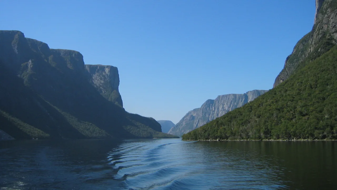
Gros Morne is the park where you can put your hand on the Earth’s mantle. UNESCO listed it in 1987 for exactly that reason: 180,500 hectares of western Newfoundland where deep ocean crust and mantle rock lie exposed at the surface, beside landlocked freshwater fjords carved by ice. The two things everyone comes for are the Tablelands, an orange rock desert that has no business being at sea level, and the Western Brook Pond boat, which costs C$99 and starts with a 3 km walk.
One piece of geography decides how a visit works, and almost nobody plans around it. Bonne Bay cuts deep into the middle of the park and splits it in two. The Tablelands and the Discovery Centre sit on the south side at Woody Point; Western Brook Pond, Rocky Harbour and the big mountain are on the north. Driving around the bay takes about an hour each way. Get that wrong and you’ll burn half a day in the car on a two-day trip.
The geology, in plain words
The short version: this is a place where a piece of the ocean floor got shoved on top of a continent, and a few hundred million years of erosion then peeled the cover off.
Parks Canada puts the Tablelands rock at half a billion years old and formed in the mantle, the layer under the crust that normally sits kilometres down. When the ancient ocean closed and the Appalachians were built, a slab of ocean floor and mantle was thrust up here and stayed. UNESCO’s citation calls the park a “rare example of the process of continental drift, where deep ocean crust and the rocks of the earth’s mantle lie exposed”, and lists it under two criteria at once: one for the geology, one for the scenery the glaciers left behind.
That isn’t a museum diorama. It’s a hillside you walk on.
The Tablelands: a walk on the Earth’s mantle
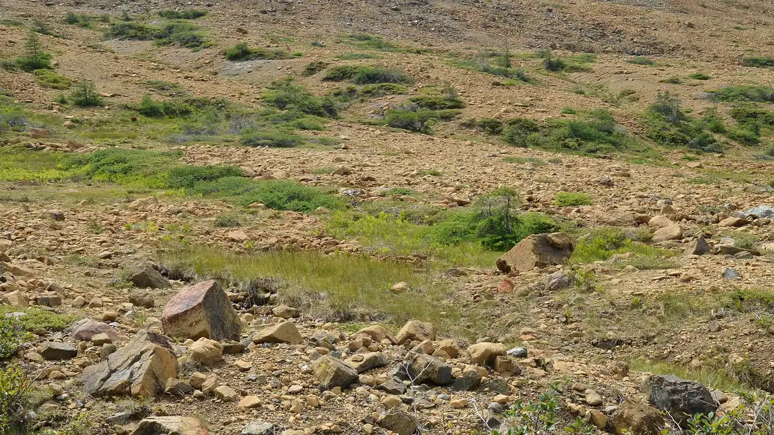
The colour is the giveaway. Mantle rock is heavy in iron, the iron rusts, and the whole massif reads orange-brown against a landscape that is otherwise green and grey. It’s also hostile to ordinary plants, which is why the slopes stay bare while spruce grows thick a few hundred metres away.
Walking it is easier than it looks. The Tablelands Trail is rated easy - 4 km return, 1 to 2 hours, 88 m of climbing - and it follows an old roadbed to the glacially carved Winter House Brook Canyon, so you can be standing on mantle rock twenty minutes after parking. The Serpentine Loop branches off for a longer wander. If you want the story rather than just the rock, Parks Canada runs a two-hour guided walk with the blunt title “Walk Upon the Earth’s Mantle”, and on a first visit it’s worth the time - the interpreters explain what you’re actually looking at, which is not obvious from the trail.
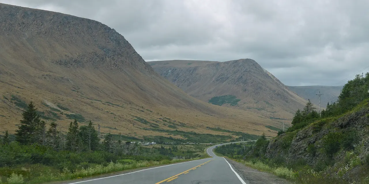
Even the drive earns its keep. Route 431, between Woody Point and Trout River, runs right along the line where the mantle rock stops and normal ground begins, and you can watch the boundary go past the car window.
Western Brook Pond: the fjord you have to walk to
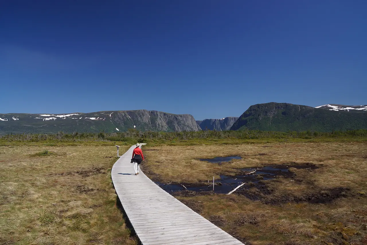
Western Brook Pond is the picture on the postcard: a glacier-carved landlocked fjord, walls Parks Canada dates at a billion years, waterfalls dropping from a plateau some 2,000 feet - about 600 m - above the water. The word “pond” is Newfoundland understatement - it’s the largest lake in the park.
Here’s the part that surprises people. There’s no road to the water. Getting on the boat means a 3 km trail from the parking lot, about 45 minutes each way, flat gravel across open bog. It’s easy walking, but budget for it honestly: with the two-hour cruise and the walk back out, the whole outing runs close to four hours before you’ve driven anywhere.
The tour is run by BonTours rather than by Parks Canada, and it’s priced separately from your park pass: C$99 for an adult and C$55 for a youth or child, plus HST, for two hours on the water with live interpretation. The boat needs a minimum of 15 people to sail, and in high summer the sailings fill days ahead, so book online instead of turning up. The boats have covered decks and washrooms on board, and there’s a sheltered waiting area, washrooms and a canteen at the dock. Dogs stay behind.
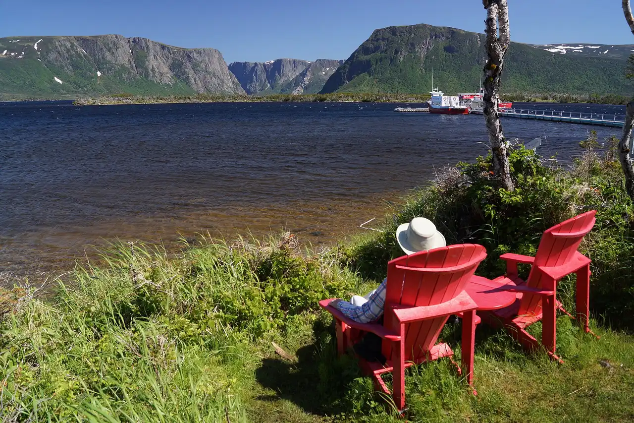
One honest note on weather: this is the Atlantic, and a fjord makes its own cloud. A grey sailing still shows you the walls, but the waterfalls and the sheer scale read best on a clear day, so if your dates allow it, hold a spare morning and take the better forecast.
Crossing Bonne Bay without the hour in the car
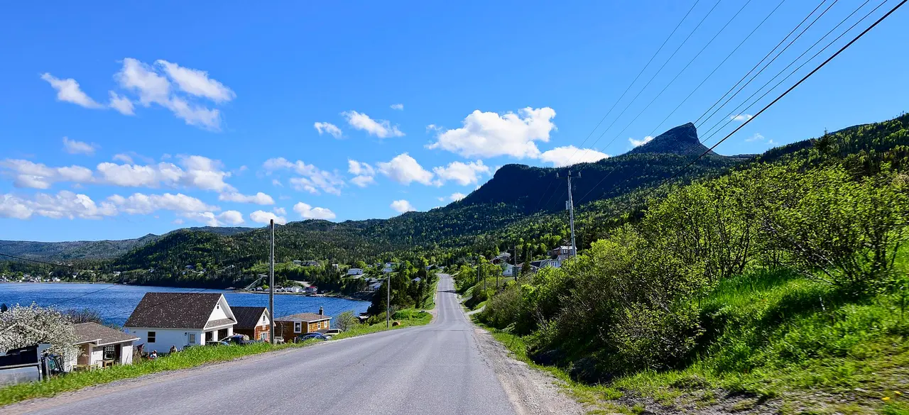
This is the trick that saves a day. Instead of driving around Bonne Bay, walk onto the water shuttle between Norris Point and Woody Point: about 15 minutes on the water, and in 2026 it starts on 8 June. One way costs C$10 for an adult, C$8 for a youth or child, C$22 for a family of two adults and two children, and C$12 with a bicycle, plus HST. Departures leave Norris Point at 9:00, 12:30, 15:00 and 17:00, and Woody Point at 9:30, 13:15, 15:30 and 17:30.
The catch is obvious once you say it out loud: the shuttle carries people, not your rental car. It works beautifully if you’re based on one side and want a day on foot on the other, or if you’re travelling by bike. If you need the car with you at the Tablelands trailhead, you’re driving around, and that’s the hour back.
Hiking, and the closure that catches people out
Gros Morne Mountain is the park’s namesake and its hardest day: about 806 m, the second highest peak on the island, with a flat Arctic-alpine summit looking down on Bonne Bay and Ten Mile Pond. Parks Canada rates the full route at 17 km return, 6 to 8.5 hours, and 1,000 m of climbing.
Now the trap. The summit section closes on 1 May each year and reopens on 28 June, to protect rock ptarmigan, Arctic hare and caribou through their weeks of breeding and growth. Plenty of people build a June trip around climbing it and find out at the trailhead. The approach trail stays open, and it’s a decent half-day walk in its own right, but the summit isn’t negotiable in that window.
| Trail | Distance | Time | Rating |
|---|---|---|---|
| Gros Morne Mountain (James Callaghan) | 17 km return | 6-8.5 h | Difficult |
| Approach section only | 9 km return | 2.5-3.5 h | Moderate |
| Summit loop | 8 km loop | 3.5-5.5 h | Difficult |
| Green Gardens | 9 km return | 3-4 h | Moderate |
| Lookout Trail | 5.8 km loop | 2-3 h | Moderate |
| Tablelands Trail | 4 km return | 1-2 h | Easy |
| Berry Head Pond | 2 km loop | 0.5-1 h | Easy |
If you have one walking day and you’re not chasing the summit, Green Gardens is the pick: it drops off the barrens to green coastal meadows and sea stacks, which is a completely different park from the Tablelands twenty minutes down the road.
Fees, and the free window in 2026
Daily admission in 2026 is C$12.25 for an adult, C$10.75 for a senior, free for youth 17 and under, and C$24.50 for a family or group - the same national schedule you’ll pay in the Rockies. Camping in peak season, 12 June to 14 September, runs C$34.00 a night unserviced and C$43.75 serviced at Berry Hill or Green Point.
The 2026 sweetener was national: admission to every Parks Canada place was free from 19 June to 7 September 2026 under the Canada Strong Pass, with 25 percent off camping on top; from 8 September 2026 the standard fees apply again (adult C$12.25, family or group C$24.50, youth free). It didn’t cover the boat tour, which is a private operator’s product. Campsites go on sale months before any of that - Gros Morne’s 2026 launch was 11 February at 8:30 am Newfoundland Time - and the mechanics of those releases are the same countrywide, which our guide to camping in Canada sets out park by park.
Where to base yourself
Rocky Harbour is the practical default: it’s on the north side, close to Western Brook Pond and the mountain trailhead, and it has the Visitor Centre, open 09:00 to 17:00 through the main season - 15 May to 12 October 2026 - and outside those dates it stays open year-round on reduced off-season days, fewer days a week and shorter hours, published season by season at parks.canada.ca. Norris Point is quieter, just up the road, and it’s where the water shuttle leaves from.
Woody Point, on the south side, is the prettier village and puts you close to the Tablelands, with the Discovery Centre next door - open 09:00 to 17:00 from 1 June to 7 September 2026, then 09:00 to 16:30 from 8 September to 12 October 2026, and that is the whole published season: outside those dates Parks Canada lists no hours for the Discovery Centre, so check parks.canada.ca before you make the drive around the bay. Trout River is smaller again and further out along Route 431.
Which one you choose comes down to what you came for. Two nights north plus one night south removes the Bonne Bay drive entirely; one base on the north side with a shuttle day out of Norris Point is the cheaper version of the same idea.
Getting there, and how long to stay
Fly into Deer Lake (YDF). Parks Canada puts the airport 35 km from the southern park boundary, roughly half an hour, which makes this one of the easiest big Canadian parks to reach by air. If you’re driving up from the Marine Atlantic ferry at Port aux Basques, it’s about four hours north to the same boundary. And if you’re coming from St. John’s, don’t underestimate the island: that’s roughly 700 km and 8 to 9 hours, a driving day rather than a morning.
Three days is the honest minimum: one for the Tablelands and the south side, one for Western Brook Pond, one for a hike or the coast. Two days works if you accept skipping one of the headliners. A week lets you carry on to L’Anse aux Meadows and the Viking site up the Great Northern Peninsula, another 370 km north, which our Newfoundland and Labrador guide covers along with the rest of the island.
One more thing worth knowing before you land: Newfoundland keeps its own clock, half an hour ahead of Atlantic Time. Flights and boat departures run on it, so set your watch when you arrive rather than after you’ve missed a sailing. The paperwork side of the drive is in renting a car in Canada, and if you’re still pinning down the month, the best time to visit Canada works through the seasonal trade-offs on the Atlantic coast.
On the map
The map loads on click - to keep the page lightweight.
The map didn’t load. Check your connection and refresh the page.
Admission and opening hours
- Admission price
- Daily admission 2026: adult C$12.25, senior C$10.75, youth 17 and under free, family or group C$24.50. Admission to all Parks Canada places was free from 19 June to 7 September 2026 under the Canada Strong Pass, which also took 25 percent off camping; standard fees again from 8 September 2026. The Western Brook Pond boat tour is run by a private operator and is charged separately: C$99 adult, C$55 youth or child, plus HST.
- Opening hours
- The park is open year-round. Visitor Centre at Rocky Harbour: 15 May to 12 October 2026, 09:00-17:00, with reduced off-season days through the winter. Discovery Centre at Woody Point: 15 to 31 May and 8 September to 12 October 2026, 09:00-16:30; 1 June to 7 September 2026, 09:00-17:00; outside those dates Parks Canada publishes no hours for it - check parks.canada.ca. The Gros Morne Mountain summit trail is closed from 1 May and reopens 28 June.
Fees, boat prices and centre hours change each season - confirm at parks.canada.ca and with the boat operator before you travel.
Details checked: August 4, 2026
Read also

National parks · 11 min read
Point Pelee: Birding, Monarchs and Canada's Southern Tip
Verified · August 29, 2026Point Pelee in practice: the shuttle to the Tip, monarch season timing, Festival of Birds dates, 2026 fees, and why free admission ended before the peak.

National parks · 8 min read
Kluane: Icefields, Flightseeing and Mount Logan
Verified · August 28, 2026Kluane National Park 2026: Kathleen Lake trails, C$30 camping, Rocking Star flights from C$250, and Mount Logan at 5,959 m.

National parks · 7 min read
Riding Mountain National Park: Bison, Clear Lake & Highlands
Verified · August 27, 2026Riding Mountain in 2026: Lake Audy bison from your car, Clear Lake beaches, Wasagaming camping fees and the drive from Winnipeg.

National parks · 8 min read
La Mauricie National Park 2026: Parkway, Lakes & Camping
Verified · August 26, 2026La Mauricie NP: two hours from Montreal or Quebec City. 2026 gate C$10, 64 km Parkway, camping from C$33.75, Navette Nature shuttles.