Newfoundland and Labrador Travel Guide
Newfoundland and Labrador in 7 to 10 days: St. John's, Gros Morne's mantle rock, the Vikings at L'Anse aux Meadows, icebergs and whales.
Newfoundland and Labrador is Canada’s far east and its strangest, most rewarding province to travel. In one loop you get the painted row houses of St. John’s stacked above a cliff-ringed harbour, the geology of Gros Morne where the Earth’s mantle lies bare at the surface, a thousand-year-old Viking settlement, and icebergs drifting past fishing villages in spring. It’s big and remote - plan 7 to 10 days for the island alone - and it keeps its own clock, Newfoundland Standard Time, exactly half an hour ahead of everyone else. Come in late May and June for the most icebergs, or June and July to add the whales.
The first thing to get right is the scale, because the island is far bigger than it looks and the highlights sit at opposite ends of it - you’ll feel that on day three. St. John’s to Gros Morne is roughly 700 km, an eight- to nine-hour drive, and Gros Morne to the Viking site at the northern tip is another 370 km on top. Trying to “do” the whole island in a long weekend is the classic mistake; pick the east or the west for a week, and only join them if you’ve got ten days or more.
St. John’s, Signal Hill and Cape Spear
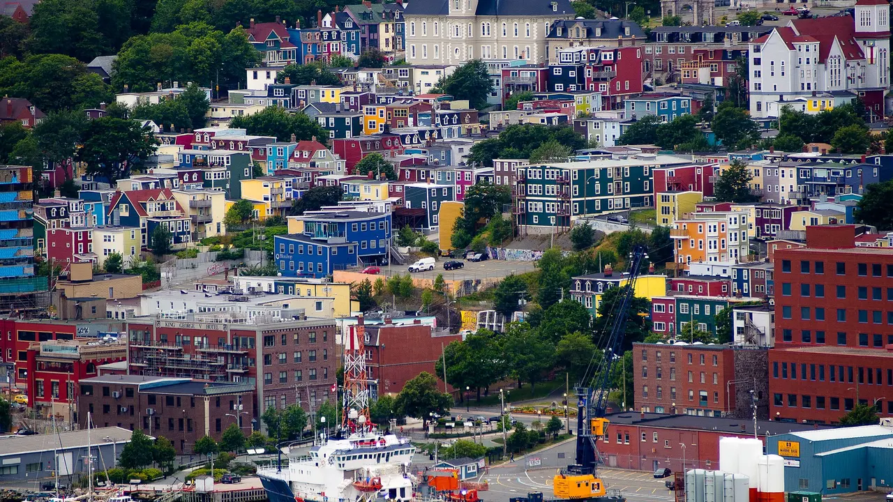
The capital, St. John’s, is a working port wrapped in colour. The Jelly Bean Row houses - rows of downtown homes painted every shade there is, partly to stand out in the fog - are the postcard, but the city also has George Street, a single block with more pubs than seems structurally wise, and The Rooms, the museum, gallery and archive on the hill above the harbour. Don’t skip the hill view.
Below it the Battery, a knot of houses pinned to the rock at the harbour mouth, is one of the most photographed corners of the city, and a short drive south the Witless Bay Ecological Reserve is the summer home of the Atlantic puffin, the provincial bird, along with whales and more seabirds than you’ll count in an afternoon.
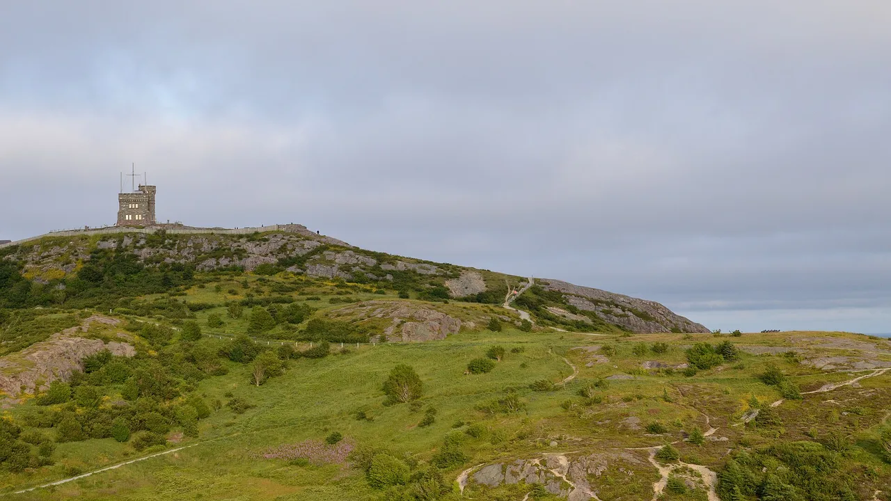
Above the narrows stands Signal Hill, crowned by Cabot Tower. It was here, on 12 December 1901, that Marconi received the first transatlantic wireless signal, the Morse letter S tapped out from Cornwall and pulled in on an aerial held up by a kite. The hill was also the site of the last North American battle of the Seven Years’ War, in 1762; today it has the best views in the city and a steep trail down to the Battery.
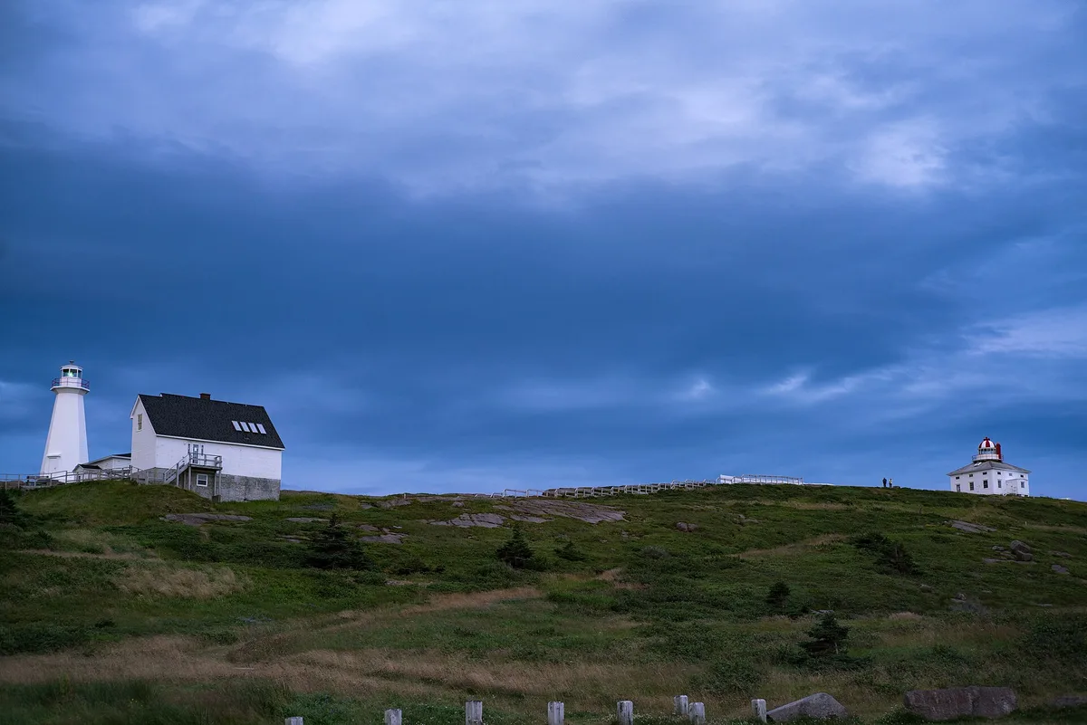
About 15 km south, Cape Spear is worth the 20-25 minute drive for a precise claim: Parks Canada calls it Canada’s most easterly point of land. You’ll see it billed as the easternmost point of North America too, but that only holds if you leave out Greenland, so the careful wording is the Canadian one. Its lighthouse is the oldest surviving in the province, showing a light since 1836, and there’s a WWII gun battery dug into the headland.
Gros Morne and the mantle rock
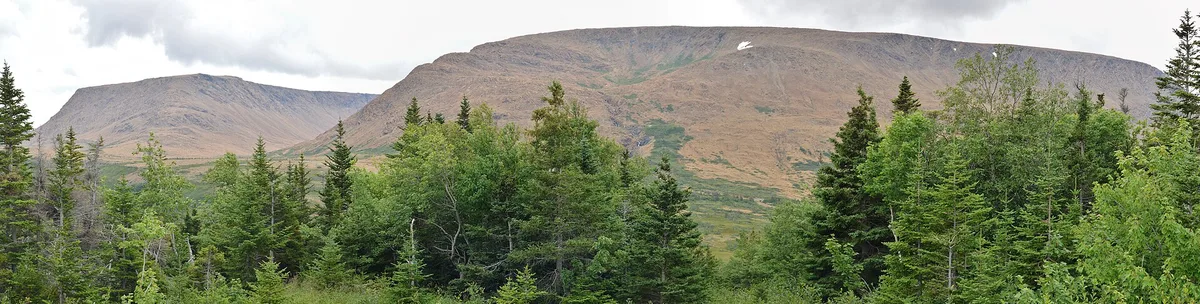
On the west coast, Gros Morne National Park was made a UNESCO World Heritage Site in 1987 for a reason you can walk up to and touch: it lays bare the machinery of plate tectonics, with deep ocean crust and the rocks of the Earth’s mantle pushed to the surface. The star is the Tablelands, a flat-topped, rust-orange rock desert so hostile to normal plants that it looks like Mars parked beside the green fjords next door. That colour is mantle rock, ordinarily kilometres underground.
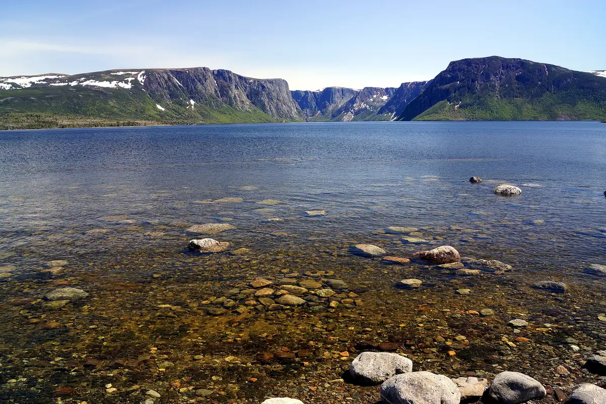
The park’s other headline is Western Brook Pond, a glacier-carved freshwater fjord walled by cliffs, reached by a boat tour that starts with a walk of about 45 minutes each way. Admission was free from 19 June to 7 September 2026 under the Canada Strong Pass and is charged again from 8 September 2026. Our Gros Morne National Park guide covers the boat schedule, the summit closure and how long to budget for the whole visit.
L’Anse aux Meadows and the Vikings
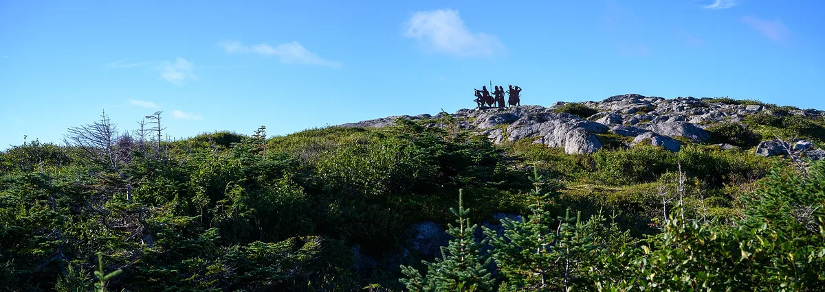
At the very northern tip of the island, L’Anse aux Meadows is where the Vikings actually reached. A UNESCO site since 1978 - it was on the first World Heritage List, and it was Canada’s first - it is, in Parks Canada’s careful phrasing, “the first known evidence of European presence in the Americas.” Norse expeditions from Greenland built a small camp of timber-and-sod buildings here over a thousand years ago, roughly five centuries before Columbus. There are reconstructed sod huts to walk into and original artifacts on display, and getting here’s the long haul the distances above warned about. For a first-hand account of a visit, including Norstead Viking Village nearby and where to eat and stay around L’Anse aux Meadows, see travel writer Wendy Nordvik-Carr’s guide on Life’s Incredible Journey.
Icebergs and whales
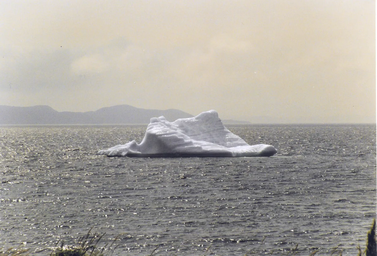
Spring is the season the province is quietly famous for. April and May are when the icebergs are most plentiful, with late May and early June the sweet spot once the sea ice clears. About 90% of them calve off the glaciers of western Greenland, and the ice in them is roughly 10,000 years old. They drift down Iceberg Alley from Labrador along the east coast, and the reliable towns to hunt them from are Twillingate, St. Anthony, Bonavista and Bay Bulls; the site IcebergFinder.com maps them in real time. Nobody can promise you a berg on a given date, so give yourself a few days and a flexible plan.
A few weeks later the whales arrive. The province hosts the world’s largest population of feeding humpbacks, present from roughly May to September and peaking in late June and July, when the capelin - small fish spawning on the beaches - draw them in close to shore. The efficient move is a single boat tour out of Bay Bulls or Witless Bay that can turn up bergs, whales and puffins in one trip. Still choosing between provinces? Whale watching in Canada puts the seasons and the fares side by side.
The half-hour clock
One quirk to know before you book flights: Newfoundland runs on Newfoundland Standard Time, UTC minus three and a half hours - half an hour ahead of Atlantic Time, and the only active time zone in the Americas with a half-hour offset. It’s a leftover from the days when Newfoundland was its own Dominion, and it’s not a rounding error: flight times, ferry times and local broadcasts really do land on the “:30.” Set your watch when you arrive.
And Labrador
Almost everything above is the island of Newfoundland, which is where most first trips stay. Labrador, the vast mainland third of the province across the Strait of Belle Isle, is a separate and much bigger undertaking: a sub-Arctic wilderness of the Torngat Mountains, remote Inuit and Innu communities, the huge Churchill Falls power project and, on clear winter nights, a real chance of the northern lights. Reach it by the short ferry from the island’s northern tip or by air, and treat it as its own expedition rather than a day out.
Getting there and around
Most visitors fly into St. John’s Airport (YYT) on the east coast, or into Deer Lake for the Gros Morne end. The alternative, and the one that suits a road trip, is the Marine Atlantic ferry from North Sydney in Nova Scotia to Port aux Basques on the west coast, which runs year-round (a seasonal service also reaches Argentia, closer to St. John’s). Either way you want a car once you land - the island is too big and too empty for anything else.
Two practical notes. The weather does what it likes, so build in slack. And the food is worth seeking out: the traditional Jiggs’ dinner and the province’s cod and berry dishes are covered in our Canadian food guide. For the drive itself, our guide to renting a car in Canada covers the ferry-and-road logistics.
Read also
- Where the Marine Atlantic ferry sails from: Nova Scotia travel guide
- Cod, capelin and Jiggs’ dinner: Canadian food, what to try
- Aurora is possible up in Labrador: northern lights in Canada
- Every province and territory: the provinces hub
On the map
The map loads on click - to keep the page lightweight.
The map didn’t load. Check your connection and refresh the page.
Read also

Provinces · 12 min read
Alberta Travel Guide: What to See and How Long
Updated · September 14, 2026Alberta beyond the Rockies: six UNESCO sites, the badlands, park fees after the 2026 free-entry window, the pass rental cars still need, and when to go.

Provinces · 9 min read
British Columbia Travel Guide: The Five Trips
Updated · September 14, 2026British Columbia is bigger than France and Germany combined: the five realistic trips, how many days each needs, the ferry to the island and when to go.

Provinces · 10 min read
Manitoba Travel Guide: Bears, Belugas and Winnipeg
Updated · July 24, 2026Why Manitoba is two trips: walkable Winnipeg and the Forks, and Churchill, the fly-in north for polar bears, belugas and the northern lights.

Provinces · 8 min read
New Brunswick Travel Guide: Fundy and Two Tongues
Updated · September 14, 2026New Brunswick, the Bay of Fundy province: Hopewell Rocks and record tides, Saint John, Fredericton and Canada's only bilingual province.