Nunavut Travel Guide: The Fly-In Arctic
Nunavut is Canada's fly-in Arctic: no road in or between communities, the country's most remote and costly trip, and an Inuit homeland of fiords and ice.
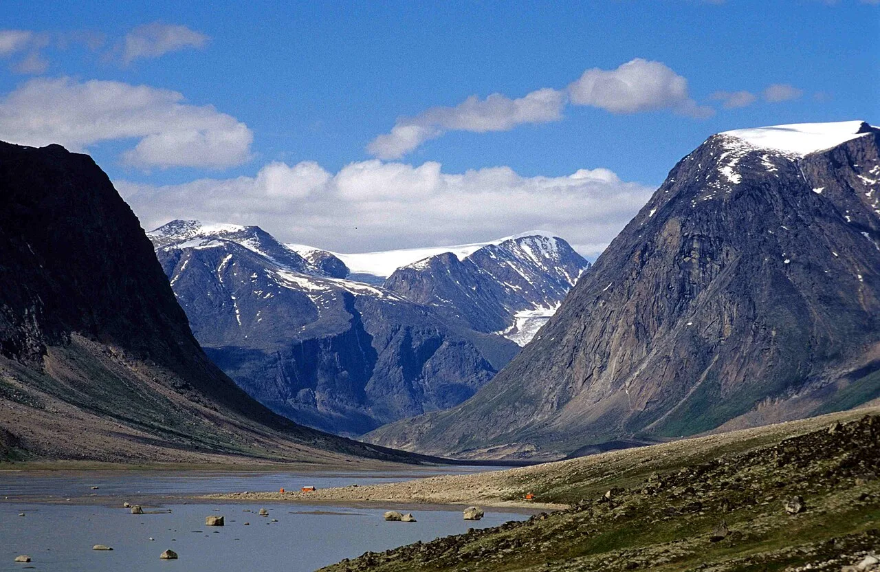
Nunavut is the one place in this whole guide where the usual travel advice falls apart. There are no roads between its communities, and no road connects the territory to the rest of Canada at all. You fly to everything. It’s Canada’s largest, newest and northernmost territory, created in 1999, and it’s also the most remote and most expensive place in the country to visit, an Inuit homeland of fiords, glaciers and sea ice that rewards travellers who plan carefully and go with local guidance.
So this isn’t a spontaneous trip, and it’s not cheap, and it’s not a place you “pass through.” Set those expectations first and the rest makes sense: you build a Nunavut trip around Inuit-run outfitters, short Arctic seasons and weather-dependent flights, and in return you get a part of Canada almost no one sees.
First, the thing no one tells you: there are no roads
It bears stating plainly because it changes everything. Nunavut spans about two million square kilometres, roughly a fifth of Canada, and holds around 25 communities, and not one of them is joined to another by a permanent road. Nor is there any road in from the south. People and freight move by air, or seasonally by sea when the ice allows, and that single fact drives the cost, the planning and the pace of any trip here.
What it means in practice is that every leg is a flight. You reach the territory by jet from the south, then continue to smaller communities on smaller aircraft, and a fogged-in day that grounds everything is a normal part of the experience rather than a disaster. Budget for it, build in spare days, and treat the weather as the one thing you can’t argue with.
Iqaluit and Baffin Island
Almost every visitor arrives in Iqaluit, the capital and by far the largest community, home to about 8,500 people at the head of Frobisher Bay on Baffin Island. Jets fly in from Ottawa and other southern hubs, and from here the smaller planes fan out across the territory. It’s a real working town rather than a resort, with a strikingly modern legislature, Inuit art at every turn and the tundra starting where the last street ends.
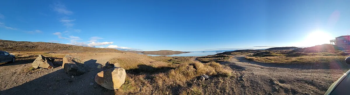
Most travellers use Iqaluit as the hinge of a trip rather than the destination in itself: a night or two to arrange logistics, buy last supplies and meet an outfitter before flying on to the parks or the floe edge.
The Arctic parks
Nunavut’s national parks are among the least-visited and hardest-to-reach in Canada, and the numbers prove it. They’re not drive-up sights; they’re guided expeditions you commit to well in advance.
Auyuittuq: the land that never melts
Auyuittuq is an Inuktitut word meaning “the land that never melts,” which tells you what you’re getting into. The park sits on Baffin Island’s Cumberland Peninsula, within the Arctic Circle, reached from the communities of Pangnirtung or Qikiqtarjuaq, and its classic traverse is the multi-day Akshayuk Pass between the fiords. Somewhere in that granite is Mount Thor, whose sheer face is widely cited as the greatest purely vertical drop on Earth, about 1,250 metres of overhanging rock. That the park logged just 251 visits in 2024-25 tells you how few people ever stand under it.
Sirmilik: Bylot Island and the floe edge
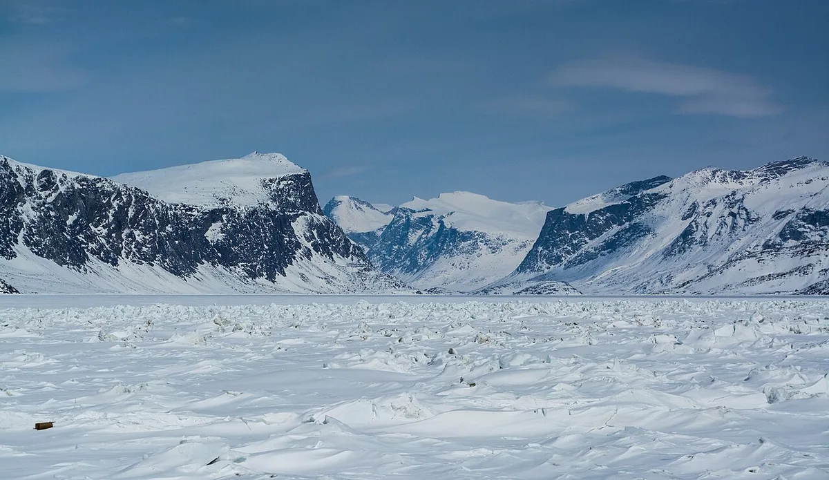
Further north, Sirmilik National Park wraps around Bylot Island and the coast near Pond Inlet (Mittimatalik), a world of glaciers, red-rock hoodoos and some of the largest seabird colonies in the Arctic. Its signature season is spring, when travellers camp at the floe edge, the shifting line where the fast ice meets open water, and watch for narwhal, seals and polar bears with Inuit guides who know the ice. Sirmilik draws only a tiny trickle of visitors, fewer than sixty in 2024-25, and the seabirds and narwhal that pull them north largely have the place to themselves. Reaching it means a boat or snowmobile trip from Pond Inlet with a local outfitter, arranged well ahead, because nothing about this coast happens on a whim.
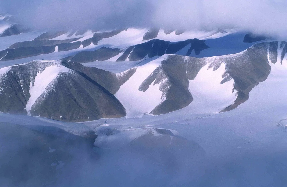
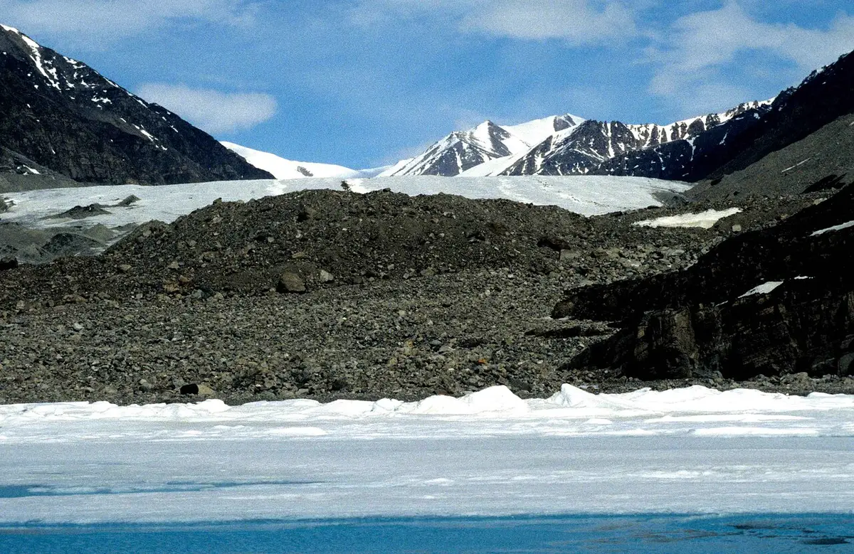
The ice itself is half the show. In spring and early summer, icebergs calved off Greenland and the high Arctic drift down the Baffin coast, and glaciers spill straight to tidewater off Bylot Island.
Inuit homeland, and travelling with respect
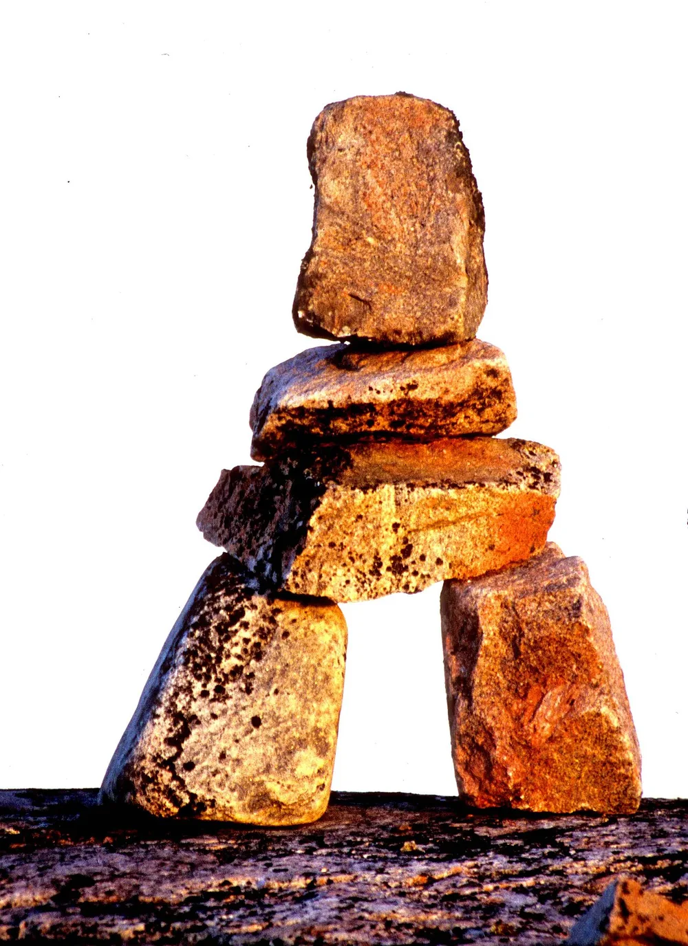
The real reason to come isn’t a checklist of sights; it’s that Nunavut is a living Inuit homeland, and you experience it through Inuit hands. This is the country of inuksuit, the stone figures built as landmarks and messages across a land with few other markers, of throat singing, of country food, and of the world-renowned printmaking of Kinngait (formerly Cape Dorset). The practical and ethical move is the same one: travel with Inuit-run and Inuit-employing outfitters, so that your trip is guided by the people whose home it’s and the money stays in the community.
Aurora reaches this far too, of course, though it’s rarely the reason people make the journey; if the northern lights are your goal, our northern lights in Canada guide points you at easier, cheaper bases further south.
When to visit
There are two short windows and not much in between. Summer, roughly June to August, is the main season: long daylight, boat access, hiking and the park trips. Spring, around April to June, is the floe-edge season, the time for narwhal and other wildlife out on the ice with a guide. Both are brief, and both bend to the weather, so whichever you choose, plan loosely and expect a lost day or two to fog and wind.
How to plan and book a Nunavut trip
Because this is the most logistics-heavy trip in the country, the planning is the itinerary. Work through it in this order:
- Go through an Inuit-run or licensed outfitter. Independent travel in the parks is for experienced Arctic expeditioners; almost everyone else should book an operator, and doing so puts your money into the community.
- Pick your season first. Summer for hiking and boat trips, spring for the floe edge, and build the rest of the trip around that short window.
- Add buffer days. Flights are weather-dependent and a fogged-in day is routine, so never plan to fly out the morning your onward connection leaves.
- Budget honestly. Flights, small-aircraft legs, guided trips and high northern food prices make this the priciest trip in Canada; go in expecting that.
- Insurance isn’t optional. A medevac from the Arctic is real and ruinously expensive, so read our travel insurance for Canada guide before you commit, and check whether you need an eTA or a visa through our Canada eTA and visas guide, since entry rules depend on your nationality and change.
- If the cost stops you, start smaller. For a first, more affordable taste of the subarctic, Churchill in Manitoba gives you polar bears and tundra at a fraction of the price.
Read also
- The other territory, and the roads it does have: Northwest Territories travel guide
- A cheaper taste of the north: Manitoba travel guide
- If the lights are what you want: northern lights in Canada
- Every province and territory: the provinces hub
On the map
The map loads on click - to keep the page lightweight.
The map didn’t load. Check your connection and refresh the page.
Read also

Provinces · 12 min read
Alberta Travel Guide: What to See and How Long
Updated · September 14, 2026Alberta beyond the Rockies: six UNESCO sites, the badlands, park fees after the 2026 free-entry window, the pass rental cars still need, and when to go.

Provinces · 9 min read
British Columbia Travel Guide: The Five Trips
Updated · September 14, 2026British Columbia is bigger than France and Germany combined: the five realistic trips, how many days each needs, the ferry to the island and when to go.

Provinces · 10 min read
Manitoba Travel Guide: Bears, Belugas and Winnipeg
Updated · July 24, 2026Why Manitoba is two trips: walkable Winnipeg and the Forks, and Churchill, the fly-in north for polar bears, belugas and the northern lights.

Provinces · 8 min read
New Brunswick Travel Guide: Fundy and Two Tongues
Updated · September 14, 2026New Brunswick, the Bay of Fundy province: Hopewell Rocks and record tides, Saint John, Fredericton and Canada's only bilingual province.