Yukon Travel Guide: The Gold Rush You Can Drive Into
The Yukon is gold-rush history you can drive into: Whitehorse and Dawson, Kluane and Mount Logan, and Canada's only road across the Arctic Circle.
The Yukon is one long story you can still drive into. Everything here traces back to the Klondike Gold Rush of 1896 to 1898: Whitehorse grew up on the river route, Dawson City sprang from the goldfields, and radiating out from both is the biggest, emptiest wilderness in the country. Learn why the two towns sit where they do and the modern trip more or less plans itself, laid over the same ground the stampeders crossed.
Most Yukon coverage picks one job or the other, a history lesson with no travel advice, or a bucket-list photo dump with no context. The useful version does both at once and uses 1898 as the map. The gold is long gone, but the roads, the river and the distances it left behind are exactly what you come to travel now.
1898 is still the map
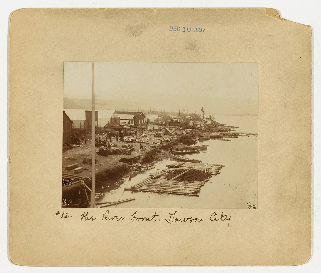
In August 1896, gold turned up on Bonanza Creek, and when the news reached the outside world the following year it triggered one of history’s great stampedes. By most accounts an estimated 100,000 people set out for the Klondike; only 30,000 to 40,000 made it all the way to Dawson City, which swelled from a few hundred people to around 30,000 in barely two years, briefly one of the largest towns west of Winnipeg. Those figures are historical estimates rather than a census, so treat them as the scale of the thing, not a headcount.
Dawson City today
The remarkable thing is how much survives. Dawson City still runs on gravel streets and wooden boardwalks, its false-fronted buildings leaning at gold-rush angles, and Parks Canada keeps the story alive at the historic townsite, the huge Dredge No. 4 and the SS Keno. You can still lose a few dollars at Diamond Tooth Gerties, the north’s oldest gambling hall, and in summer a free ferry crosses the river to the Top of the World Highway, a ridge-running gravel road toward the Alaska border that’s open only in the warm months.
The wilderness behind the towns
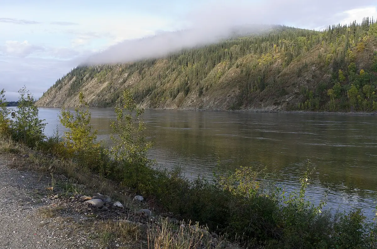
Step away from the highway and the Yukon becomes one of the last true wildernesses on the continent. Two corners of it are reachable enough to build a trip around.
Kluane and Mount Logan
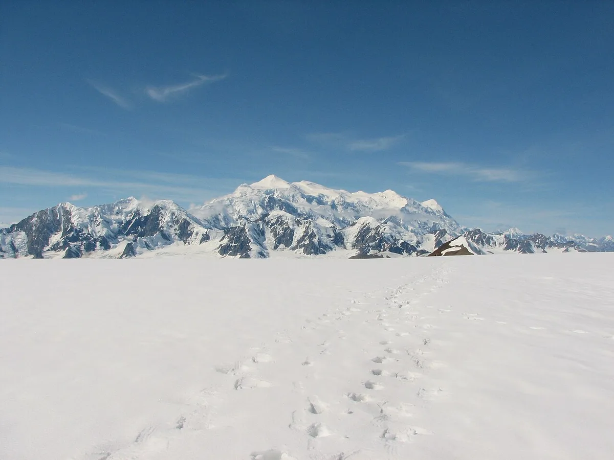
In the south-west, Kluane National Park and Reserve hides Canada’s roof. Mount Logan stands 5,959 m (19,551 ft) high, a figure fixed by a 1992 GPS resurvey, which makes it the highest mountain in Canada and the second-highest peak in North America after Alaska’s Denali. Around it lie the largest non-polar icefields on Earth, a frozen world most people only ever see from a flightseeing plane, and the park shares a UNESCO World Heritage listing with its giant neighbours across the Alaska line.
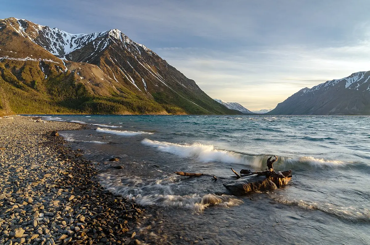
You do not need a mountaineering permit to taste it. Kathleen Lake, about 160 km west of Whitehorse on the Haines Road, is the accessible day-use anchor, with the King’s Throne trail climbing the ridge above it and grizzlies and Dall sheep in the country around. It is the one place where the scale of Kluane meets a parking lot.
Tombstone and the Dempster
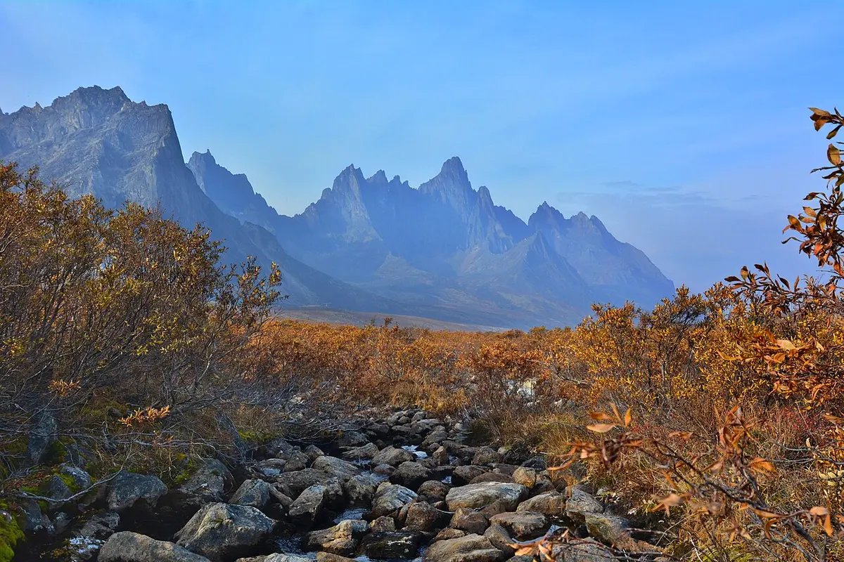
The other reachable wilderness is a road. The Dempster Highway runs about 740 km of mostly gravel from near Dawson City up to Inuvik in the Northwest Territories, and it’s the only public highway in Canada that crosses the Arctic Circle. Its first stretch threads through Tombstone Territorial Park, a serrated range of black granite peaks that turns electric orange and red in the tundra fall, roughly late August into early September. Treat the Dempster as an expedition, not a drive: carry spare tires and fuel, expect no cell service, and check the road and ferry status before you commit.
Whitehorse: the hub
Nearly every trip starts in Whitehorse, the capital and the territory’s only city of any size, home to about three-quarters of all Yukoners. It sits on the Yukon River, and the old sternwheeler SS Klondike is beached in the middle of town as a national historic site; just upstream, Miles Canyon is a quick, pretty walk to basalt cliffs the stampeders once had to shoot in their boats.
Whitehorse is also a serious aurora base. Travel Yukon puts the northern-lights season from mid-August to mid-April, and the winter town fills with travellers chasing the display between dog-sledding runs. For the practical side - when to head out, what to wear, whether to book a tour or chase it alone - see our northern lights in Canada guide; here it’s enough to know that Whitehorse ranks among the country’s best bases for it.
The great drives, and Emerald Lake
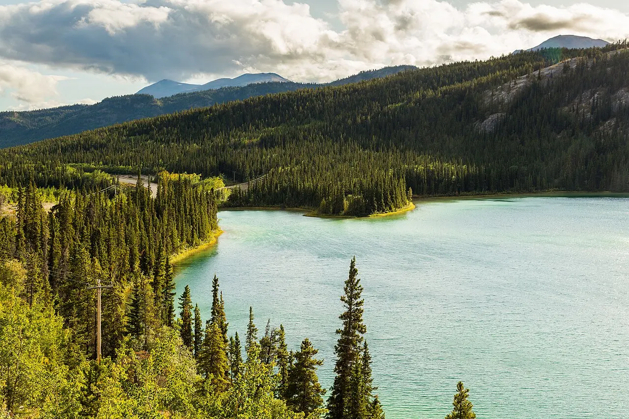
South of Whitehorse the South Klondike Highway rolls toward the Alaska panhandle past Emerald Lake, the vivid green pool on the cover of this guide. Its colour comes from light bouncing off a pale bed of clay and shell marl, and it sits near Carcross, a tiny town beside the improbable Carcross Desert, often called the smallest in the world. One quick correction for planners: this is the Yukon’s Emerald Lake near Carcross, not the more famous one in Yoho, British Columbia, so keep the two straight when you map a route.
The Dempster and the Top of the World are the big expeditions; the South Klondike is the easy, gorgeous half-day that shows you why people fall for the territory before they have driven anywhere hard. From here the road continues into the top of British Columbia and on down the Alaska Highway.
When to visit the Yukon
Summer (June to August) is the obvious season: near-endless daylight, every road and ferry open, festivals in Whitehorse and rivers running for canoes. Winter is the other Yukon entirely, built around the aurora, dog teams and a deep, dry cold. The quiet sweet spot is the shoulder, late August into September, when Tombstone catches fire, the first northern lights return and the summer bugs have gone.
How far things really are
Nothing in the Yukon is close, and the single most useful planning fact is the scale of the drives. These distances from Whitehorse are approximate, so always check current road and ferry conditions before you set out.
| From Whitehorse to | Approximate distance | Note |
|---|---|---|
| Carcross and Emerald Lake | about 75 km | South Klondike Highway, an easy half-day |
| Kathleen Lake, Kluane | about 160 km | Parks Canada figure, on the Haines Road |
| Dawson City | about 535 km | the North Klondike Highway |
| Inuvik, up the Dempster | about 535 km, then 740 km more | the Dempster starts near Dawson |
The point of the table isn’t the exact kilometres; it’s that a “quick loop” of the Yukon does not exist. Give the territory a week at the very least, and read our guide to renting a car in Canada before you book the vehicle you’ll live in for it.
Before you go
Whether you need an eTA or a visa to enter Canada depends on your nationality and the rules change, so check the official source through our Canada eTA and visas guide rather than trusting memory. On the gravel highways, fuel and a good spare matter more than anything: services are hundreds of kilometres apart and there is no phone signal to call for help, which is also why a remote-driving trip like this is one to read up on travel insurance for Canada before you go. Bears are part of the landscape here, so learn the food-storage rules before you camp.
Read also
- Where the Dempster ends and the Arctic Ocean begins: Northwest Territories travel guide
- The road south, into the mountains: British Columbia travel guide
- The aurora, in depth: northern lights in Canada
- Every province and territory: the provinces hub
On the map
The map loads on click - to keep the page lightweight.
The map didn’t load. Check your connection and refresh the page.
Read also

Provinces · 12 min read
Alberta Travel Guide: What to See and How Long
Updated · September 14, 2026Alberta beyond the Rockies: six UNESCO sites, the badlands, park fees after the 2026 free-entry window, the pass rental cars still need, and when to go.

Provinces · 9 min read
British Columbia Travel Guide: The Five Trips
Updated · September 14, 2026British Columbia is bigger than France and Germany combined: the five realistic trips, how many days each needs, the ferry to the island and when to go.

Provinces · 10 min read
Manitoba Travel Guide: Bears, Belugas and Winnipeg
Updated · July 24, 2026Why Manitoba is two trips: walkable Winnipeg and the Forks, and Churchill, the fly-in north for polar bears, belugas and the northern lights.

Provinces · 8 min read
New Brunswick Travel Guide: Fundy and Two Tongues
Updated · September 14, 2026New Brunswick, the Bay of Fundy province: Hopewell Rocks and record tides, Saint John, Fredericton and Canada's only bilingual province.