
Best Road Trips in Canada
Canada road trips, from the two-hour Sea-to-Sky Highway to the 232 km Icefields Parkway, the Cabot Trail, the Gaspesie loop and the Trans-Canada.
Canada’s drives run from a two-hour coastal cruise to a coast-to-coast crossing of nearly eight thousand kilometres. At one end is the Sea-to-Sky Highway, an easy afternoon out of Vancouver; at the other is the Trans-Canada, a 7,821 km haul from Victoria to St. John’s that’s a life-list project rather than a vacation. In between sit three of the great scenic drives on the continent. Here are five worth the tank of gas, shortest to longest, and what each is actually like behind the wheel.
Which one you pick comes down to how much time you have and what kind of country you want out the window. A spare afternoon buys you the fjords of Howe Sound. A long weekend gets you the glaciers of the Rockies or the highland cliffs of Cape Breton. A full week opens up the fishing villages of the Gaspe. And a whole summer, if you have one to spend, gets you across the country. None of them needs a fixed itinerary, only a full tank, decent tires and time to stop.
Sea-to-Sky Highway: the two-hour classic
The Sea-to-Sky is the one you can do on a whim. British Columbia’s Highway 99 climbs north out of Vancouver along the edge of Howe Sound, a steep-sided fjord, and reaches Whistler in about two hours over roughly 121 kilometres. It packs a lot into that short run: Shannon Falls dropping beside the road, the granite dome of the Stawamus Chief above Squamish, and the Sea to Sky Gondola for the view without the climb. The full length of Highway 99 runs 377 kilometres, but the famous stretch is this coastal leg to Whistler, and it’s the most accessible great drive in the country, a day trip you can turn around and be back from by dinner. It starts on the doorstep of the city, so pair it with our guide to Vancouver.
Icefields Parkway: glaciers and turquoise lakes
If one drive belongs on every Canada list, it’s this one. The Icefields Parkway, Highway 93, runs 232 kilometres between Lake Louise and Jasper through the heart of Banff and Jasper national parks, and it’s a near-continuous parade of glaciers, waterfalls and impossibly blue lakes. The Columbia Icefield spills toward the road, Peyto and Bow lakes glow that mineral turquoise, and the peaks close in on both sides. Parks Canada’s own advice isn’t to rush it: give it a full day one-way, not a three-hour dash, and you’ll still leave things unseen. You need a park pass to drive it, and there is no fuel or cell coverage along much of its length, so top up and download your maps first. This is the hub version; the full stop-by-stop drive is in our Icefields Parkway guide, and the park at its northern end is covered in our Jasper guide.
The Cabot Trail: Cape Breton’s coastal loop
Out east, the Cabot Trail is the reason people give Nova Scotia a second week. It’s a 298 kilometre loop around the northern tip of Cape Breton Island, threading in and out of Cape Breton Highlands National Park as it climbs from the sea onto a bare, windswept plateau and drops back down the far side. The signature walk is the Skyline Trail, a cliff-top boardwalk high above the Gulf of St. Lawrence where whales sometimes show below and moose graze the barrens behind you. The loop works in either direction and mixes Acadian, Gaelic and fishing culture along the way. Come in early to mid-October if you can, when the maples and birches on the highlands turn and the whole island seems to catch fire.
Tour de la Gaspesie: Route 132 around the peninsula
The Gaspe is the long one that still fits in a week, and it feels like the edge of the country. Route 132 makes a roughly 885 kilometre loop around the Gaspe Peninsula from Sainte-Flavie, running along the south shore of the St. Lawrence as it widens into the gulf. The prizes come near the tip: Perce Rock, the great pierced limestone monolith rising straight from the sea; Forillon National Park where the peninsula ends in cliffs; and Bonaventure Island, home to one of the largest northern gannet colonies in the world. In between are fishing villages, lighthouses and some of the best seafood in Quebec. Give it five days at least, more if you like to linger, and treat the province’s wider draws in our Quebec guide.
The Trans-Canada Highway: the life-list crossing
Then there’s the big one. The Trans-Canada Highway runs 7,821 kilometres from Victoria on Vancouver Island to St. John’s in Newfoundland, and it’s one of the longest national highways in the world, though sources differ on whether it takes the outright title or comes second. Either way it’s not a road trip so much as a rite of passage: ten provinces, several time zones, the prairies rolling on for days and the Canadian Shield rolling on for more. Almost nobody drives the whole thing in one go, and those who do reckon on weeks, not days. If a full crossing is the dream, break it into stages; our two-week Canada itinerary shows how to string a realistic slice of it together without living in the car.
Honourable mentions
Five drives can’t hold everything. The Viking Trail runs up Newfoundland’s Great Northern Peninsula to a thousand-year-old Norse site at L’Anse aux Meadows. The Dempster Highway pushes gravel north across the Arctic Circle to the Beaufort Sea, a serious undertaking for prepared drivers. The Alaska Highway is the other northern classic - Dawson Creek to Delta Junction, with Yukon fuel stops, seasons and border timing that need their own plan. The Okanagan wine route threads vineyards and lakes through British Columbia’s warmest valley, and the Thousand Islands Parkway traces the St. Lawrence past its scatter of islands in Ontario. Any of them could headline a trip; they lose out here only on fame, not on merit.
Renting, fuel and staying connected
A road trip in Canada is a logistics exercise as much as a scenic one, because the distances are genuinely large. Sort the car first: winter-tire rules, insurance and one-way drop fees all matter, and they’re laid out in our guide to renting a car in Canada. Fuel is easy in the south and sparse in the north, so on remote stretches you fill up whenever you pass a station rather than when the gauge tells you to; prices swing enough that it’s not worth quoting a figure. Cell coverage drops out on the Icefields Parkway, the Dempster and plenty of the Gaspe, so download offline maps and consider an eSIM for Canada before you rely on your phone for navigation. What the whole thing costs depends on the drive and the season, and our guide to how much a Canada trip costs breaks the numbers down.
When to drive
Season decides which of these is even open. The mountain and Atlantic drives are summer-and-autumn affairs, best snow-free from roughly June to October; the Cabot Trail peaks in the autumn colour, and the Icefields Parkway is a summer classic. In the cold months the high passes demand winter tires or chains, daylight runs short, and the Icefields Parkway in particular becomes a serious winter drive with no services in between. Time it against the wider calendar in our guide to the best time to visit Canada, pick the season that suits the drive, and give yourself more days than the distance suggests, because the stopping is the point.
Route day by day
- Days on the road
- 14
- Distance
- ≈7821 km
- Budget from
- 300 CAD
- Best season
- June, July, August, September, October
The route at a glance
-
Sea-to-Sky Highway (BC)
Route startVancouver to Whistler along Howe Sound in about two hours: Shannon Falls, the Stawamus Chief at Squamish and the Sea to Sky Gondola. The easy one, drivable as a day trip.
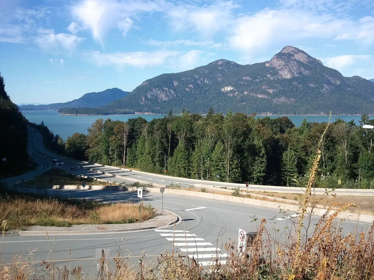
Photo: Ruth Hartnup · CC BY 2.0 · Wikimedia Commons ( source) -
Icefields Parkway (Alberta)
232 km from the startLake Louise to Jasper past glaciers and turquoise lakes; Parks Canada says to give it a full day one-way. Buy a park pass before you go.
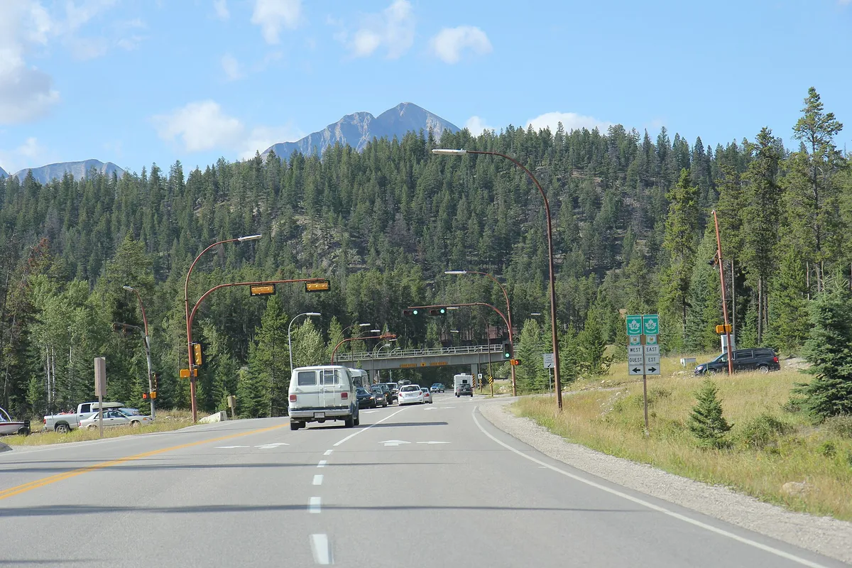
Photo: Royalbroil · CC BY-SA 3.0 · Wikimedia Commons ( source) -
Cabot Trail (Nova Scotia)
298 km from the startA 298 km loop around northern Cape Breton through the Highlands National Park: the Skyline Trail, ocean cliffs, and at its best in the autumn colour.
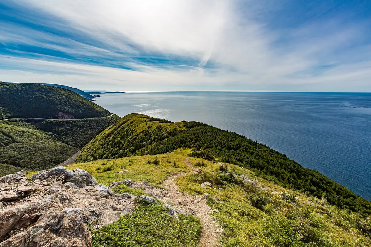
Photo: Tony Webster · CC BY-SA 2.0 · Wikimedia Commons ( source) -
Gaspesie / Route 132 (Quebec)
885 km from the startA roughly 885 km loop around the Gaspe Peninsula: Perce Rock, Forillon, the gannets of Bonaventure Island and fishing villages. Give it five days or more.
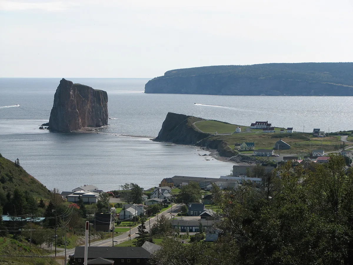
Photo: Thierry Coudray · CC BY-SA 2.5 · Wikimedia Commons ( source) -
Trans-Canada Highway
7821 km from the startThe epic: 7,821 km from Victoria to St. John's, one of the world's longest national highways. Not one vacation but a rite of passage.
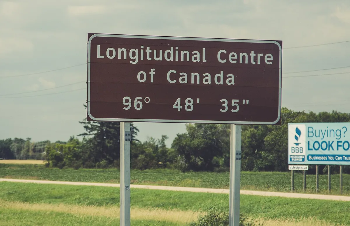
Photo: Tony Webster · CC BY-SA 2.0 · Wikimedia Commons ( source)
Route map
The map with stops loads on click - to keep the page lightweight.
The map didn’t load. Check your connection and refresh the page.